Note: more pictures coming!
After 100 days of rain I was tired of waiting for my delayed pre-Christmas walking trip to the English Lake District. At the end of February there was a slight change in the configuration of fronts and pressure lines on the North Atlantic weather map. Time to take a risk and book a few days in Borrowdale?
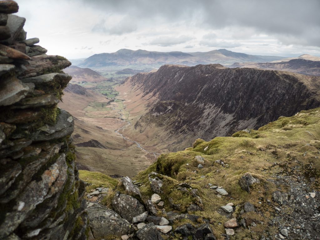
Newlands Round
An early start on the journey to the Lakes can make the difference between a half day on the fells and a short afternoon stroll. Over the years the Newlands Round has become a standard arrival day walk for Borrowdale. Would it still be possible? Each time, in planning I remember the spectacular views while descending Hindscarth ridge. I always forget how tough the uneven ground is under foot.
Download file for GPSGlaramara to Scafell Pike and the Corridor Route
Glaramara is central to Borrowdale and a lovely, slighly unruly fell. The approach is enjoyable with a gradual ascent over Thornythwaite Fell. The top is a bit wild with views to other fells in all directions but no sight of the Langstrath valley which borders the east side. It would be nice to spend a sunny day up here, just wandering about over the undulating terrain, but then the route off leads via Allen Crags to the great central cross roads for the high Lakeland Fells.
This time I headed directly to Scafell. Not to climb the top but to look. I’ve made several walks over the top of Scafell and Scafell Pike but usually from the west. Great End, Ill Crag, and Broad Crag to the East were less familiar and provide a good view of people on the Scafell Pike summit cairn. My main objective was the the return via The Corridor Route which I hadn’t done for more that 50 years. I couldn’t remember what to expect, but like most trails in popular areas there has been some path engineering to minimise potential erosion and improve safety.
I stopped halfway around to brew a cup of tea. It was a chance to sit and study Gable from the south. I could also watch a group of young people ahead on the path, they appeared to be trying to make a short-cut to Wasdale. First one, then another, then all 15 of them started down alongside a stream bed. Then they stopped. Then they all moved back up to the path. It was some time before they continued on and out of sight. After packing up I followed them and realised what their problem was – the path disappears at one point where a short scramble is needed to reconnect with the route.
Download file for GPSFleetwith Pike, Haystacks, Gable, Brandreth and Grey Knotts
Fleetwith Pike is an impressive crag when viewed from Buttermere. The route up from the Honister Pass car park is much less abrupt and follows old (and current) slate workings and abandoned buildings. The summit gives a great view of the Buttermere fells and looks over the messy top of Haystacks. It is clear from this view that the summit of Haystacks is, well, not so clear. Nevertheless it is a pleasant walk in good weather across the length of the hill top to the highest point. After a sandwich overlooking Buttermere, I turned around and headed towards the distinctive shape of Great Gable.
Moses trod provides a route that skirts Green Gable and provides a good spot for an afternoon cuppa staring at the north side of the hill and Gable Crag.
The return to Honister is over Brandreth and Grey Knotts.
Download file for GPSLangdale Pikes from Stonethwaite in Borrowdale
I’ve always ascended the Langdale Pikes from Langdale valley. This route from Stonethwaite in Borrowdale was a revelation to me. The path following Greenup Gill to Lining Crag and Greenup Edge is of enduring interest. The plain over High Raise to the Langdale Pikes is rather featureless and even in fine weather it is difficult to avoid spending some minutes tramping in the wrong direction.
Even at my slow pace I arrived at Harrison Stickle for and early lunch sandwich.
After Pike of Stickle I headed over Martcrag Moor to Stake Pass. It was probably my first time here, because I couldn’t remember such a zig-zag path which smooths out the gradient so dramatically. The Langstrath valley was quite as usual. The expected rain had failed to materialise, so I set up my stove and prepared my afternoon cuppa.
Download file for GPS