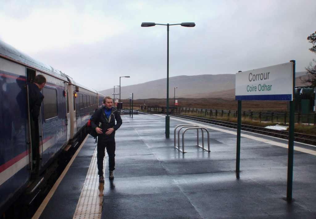
The 9.15 from Euston reaches this bit of wildness almost 12 hours later.
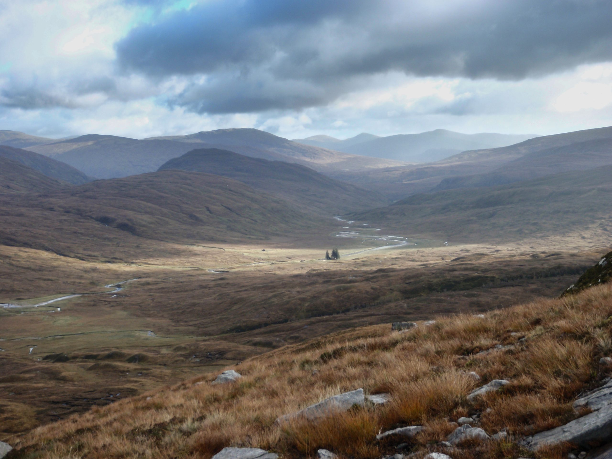
The miracle at Corrour is that the train doesn’t sink beneath the bogs, but seems to float between here and Rannock in some of the wildest land in Scotland.
Me I don’t float on the bogs and within 100m of the station I was floundering waist deep in the myre. Thank you to the other passenger alighting from the 9.15 from Euston who gave a helping tug on my rucksack to get me back to the path.

The two of us negotiated lots of water on the ground and in the air passing the end of Loch Treig to the bothy at Lairrig Laadach. For me this was to be the start of the Grey Corries traverse. My fell-running companion from Sheffield was off in the opposite direction.
Sometimes the wind is so high and noisy that it is difficult to stand or think. So it was on the ridge to Stob Choire na Ceannain that afternoon and I I withdrew to the valley and in the evening light swarmed up a good looking nearby top called Sgurr Innse.
I returned to the protection of the Bothy for the night. And later I carefully put away all my food in case of marauding mice. In the morning however the floor was scattered with Polo mints and a hole chewed into the pocket on the wasteband of my pack.
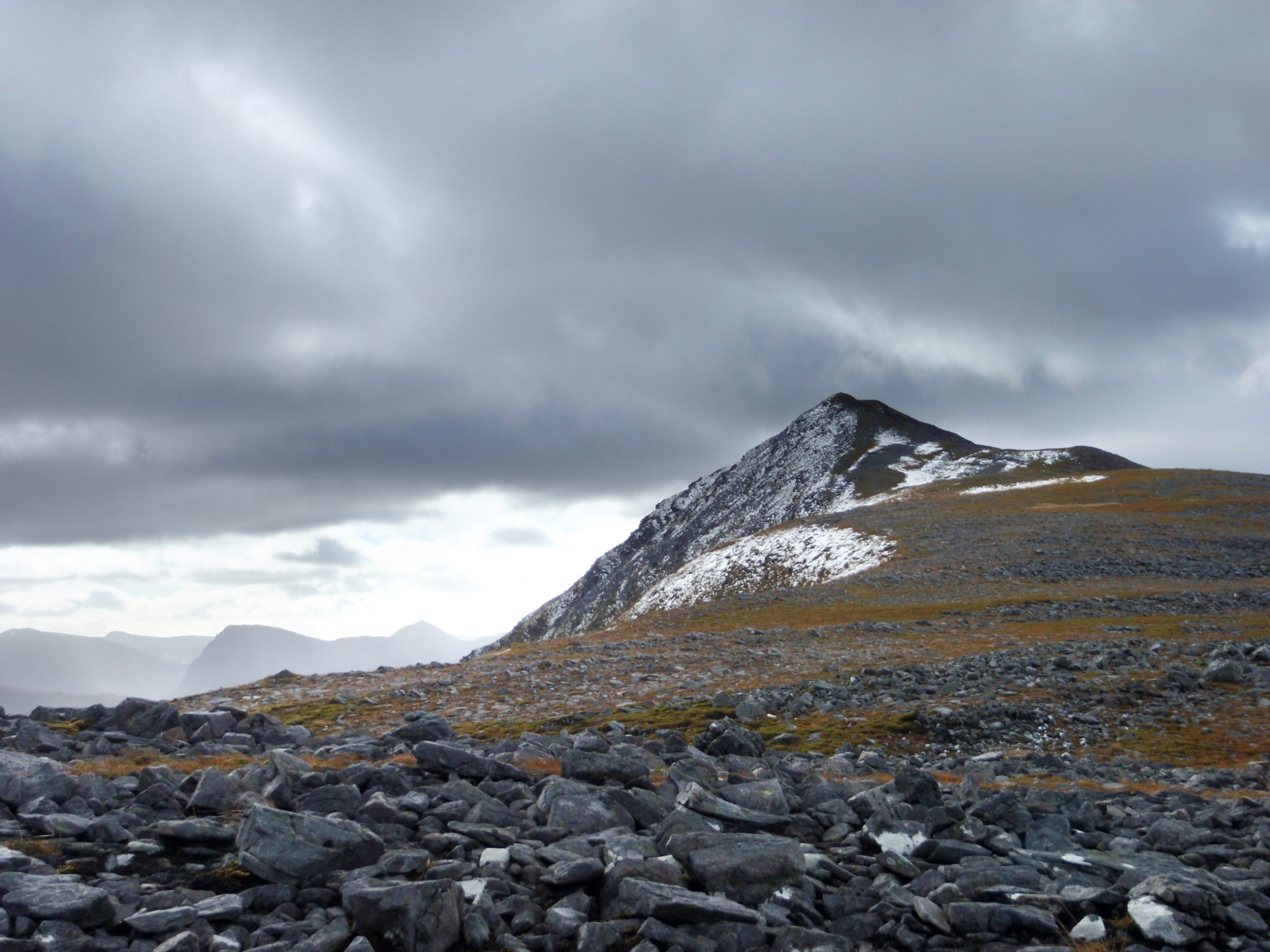
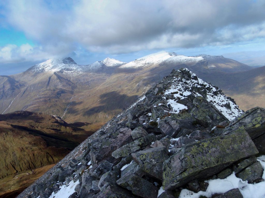
The next day another sortie to Grey Corries. On Wednesday I’d followed Ralph Storrer’s route from the top of the track from the North; this time I followed the path from the Bothy into the very attractive cwm called Cul Choirean on my map. Snow had fallen during the night and I tramped up to the ridge through thin drifts and reached up to the first top Stob Choire na Ceannain (1123m). As I looked at the narrow ridge joining this to neighbouring munro the wind suddenly blasted strong. That was the end of attempt two.
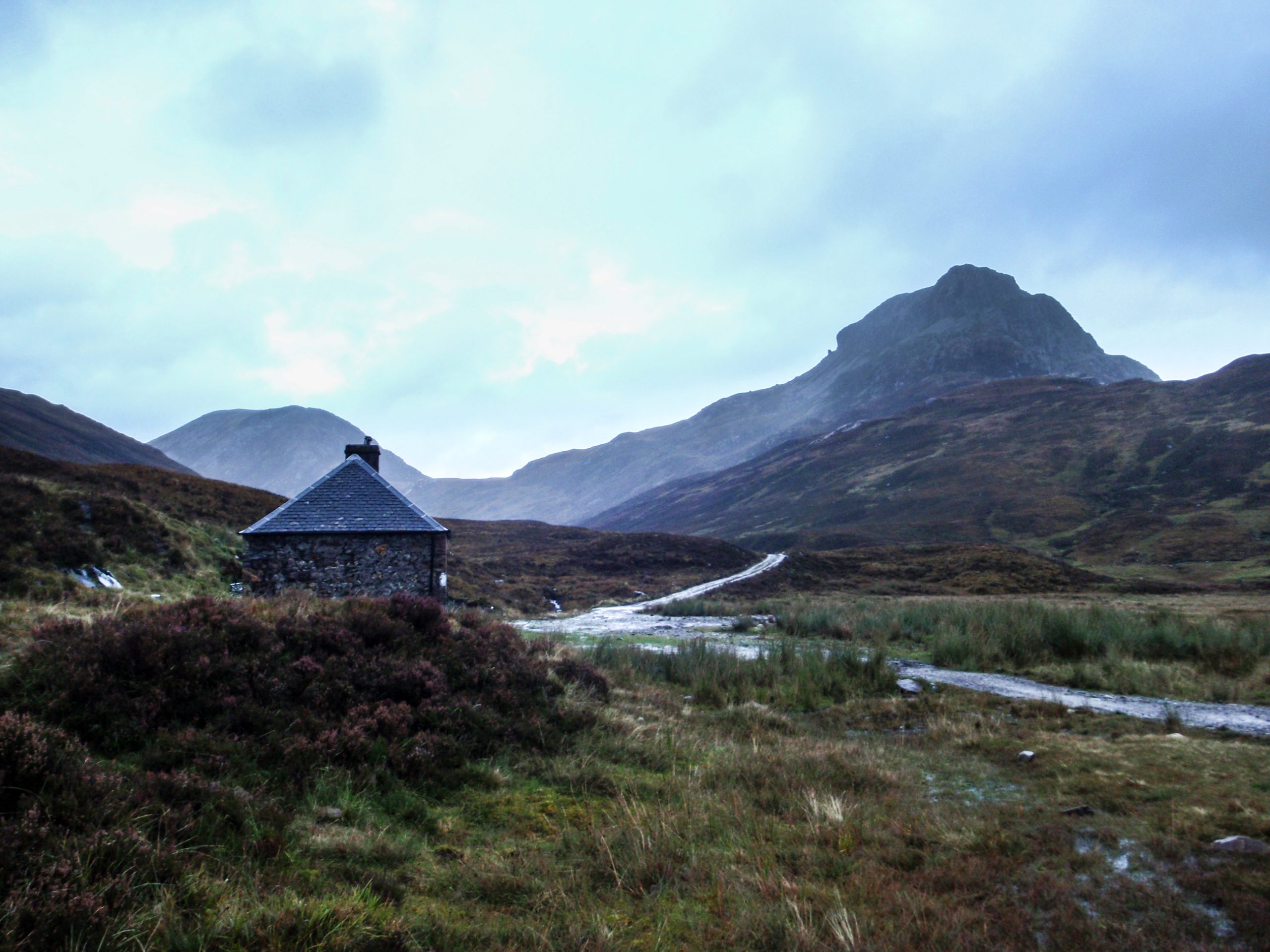
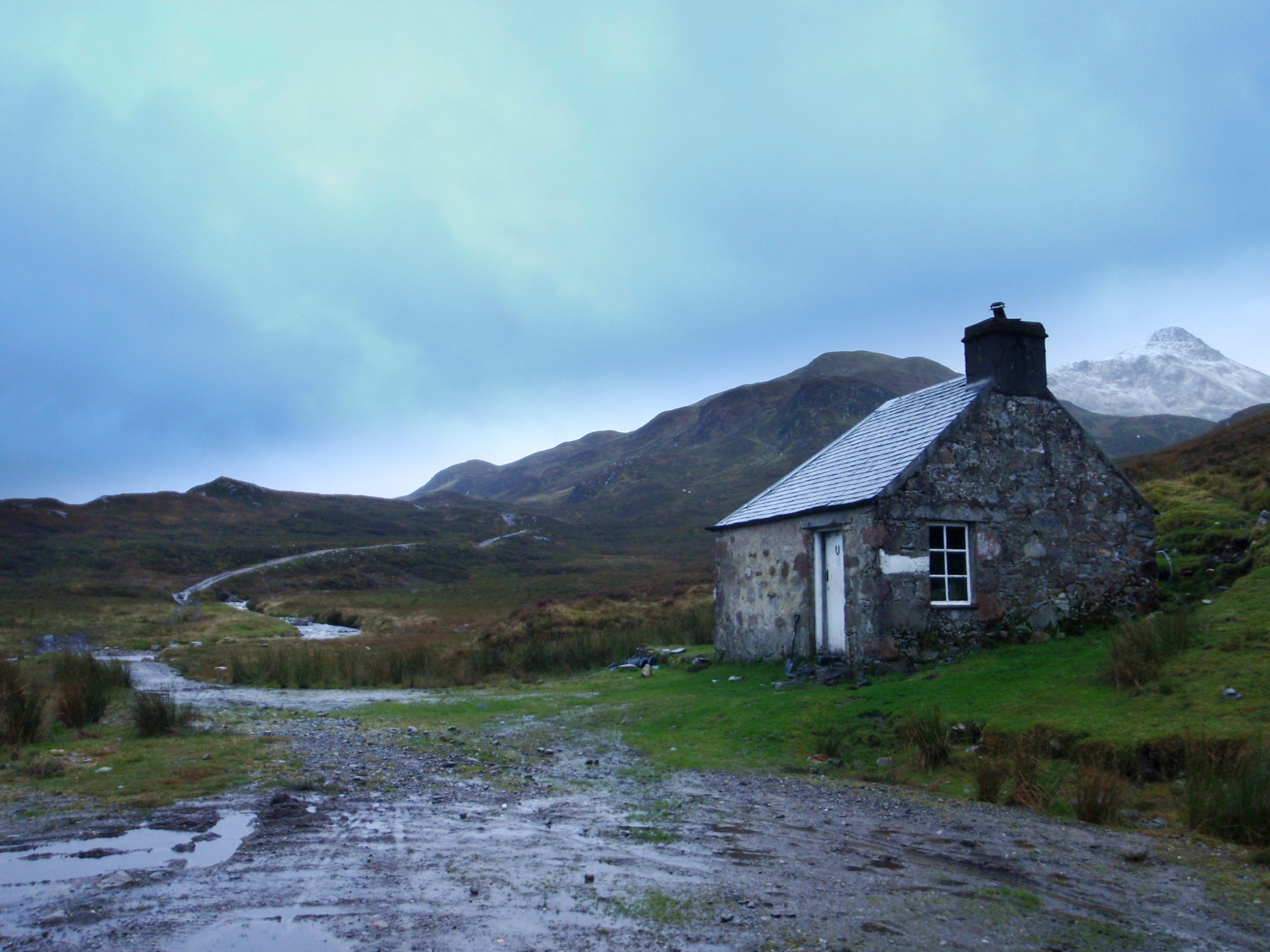
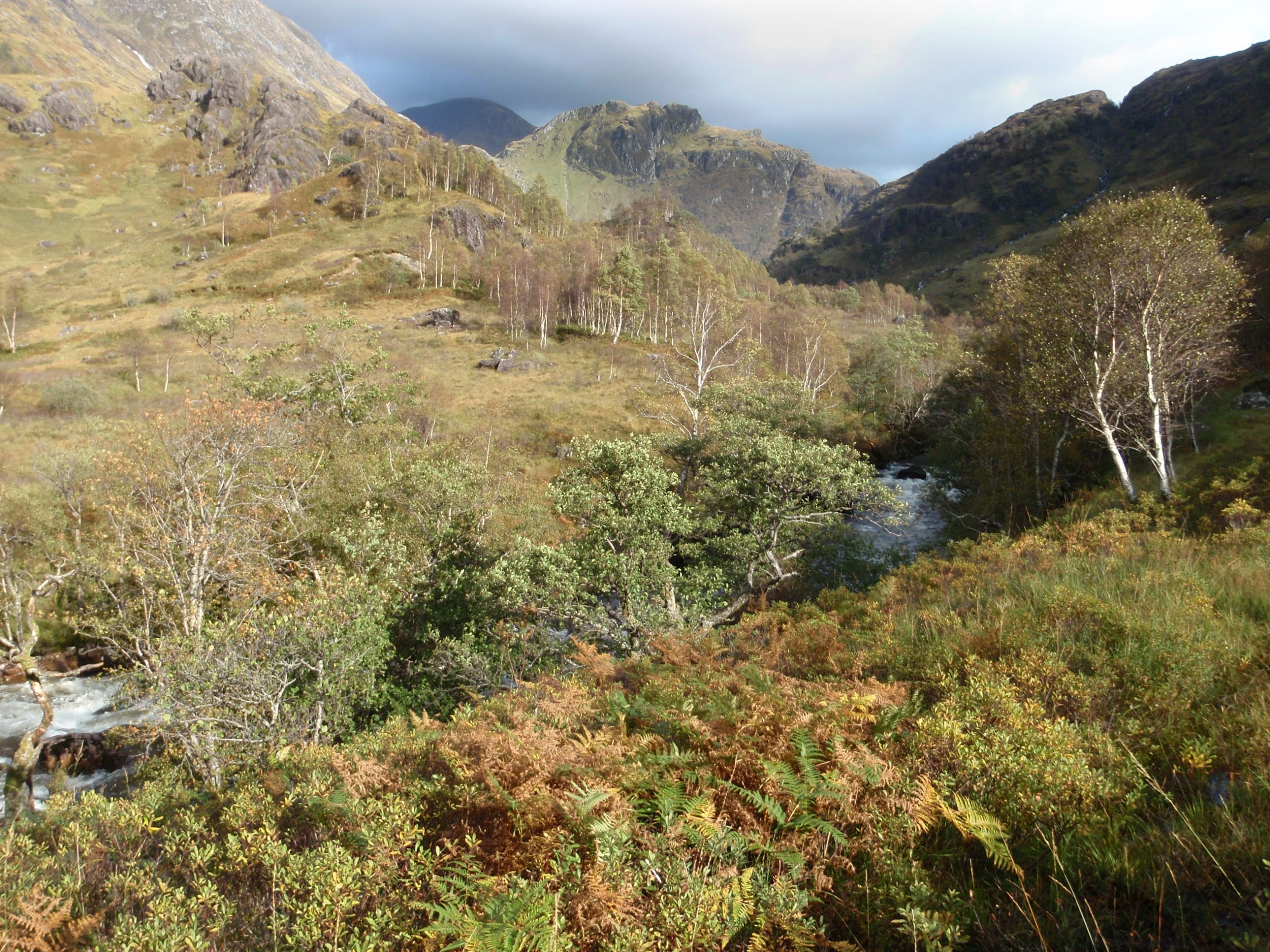
I retreated to the cwm and traversed around to the gap between the Corries and Stob Ban. By the time I reached the top of the latter it was covered in cloud. The weather varied in typical fashion from rain to snow to sunshine, but the predominate key was rain. I joined the path over to the next valley and with a couple of hours reached the charming Bothy at Meanach. All handy for a day on the Mamores.
Meanach was recommended by the fell-runner from Sheffield. He failed to mention that it is surrounded by rivers without any bridges. Nevertheless a comparatively comfortable stopover with Billy the dog and 2 companions from Huddesfield. A 2 roomer one with a wooden floor the other in stone but no sleeping platforms. I could imagine skiing out here in winter with a bit of wood for the fire to make a cosy stop, but this is pure fantasy – I don’t know how the weather is in winter and skis work well on snow but not so useful for crossing rivers.
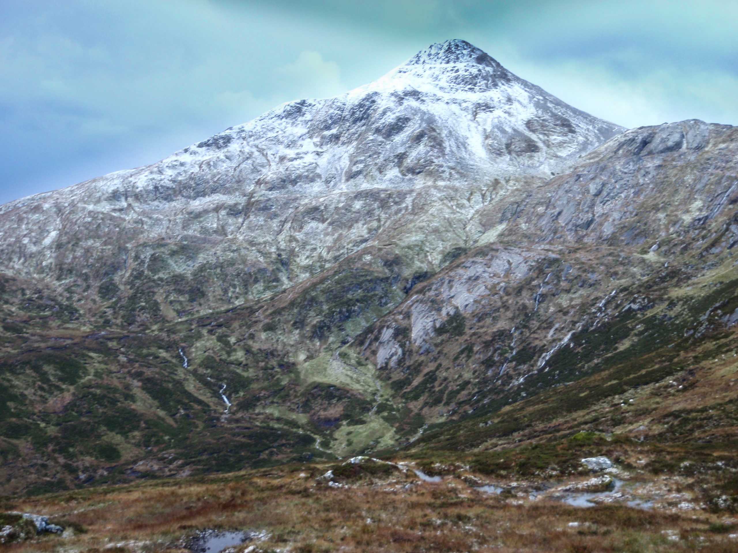
So in the morning a two mile trek upstream to find crossing points to the south side of Abhainn Rath. A footbridge crosses the second river to give access to the ridge up to Sgurr Eilde Mor. The usual uncomfortable bog and heather bashing is needed to gain the ridge, then a gradual incline takes you to the top.
A steep path leads from here slightly north of west down to the col north of the lochain beyond which a snowy ridge beckoned with several distinct tops.
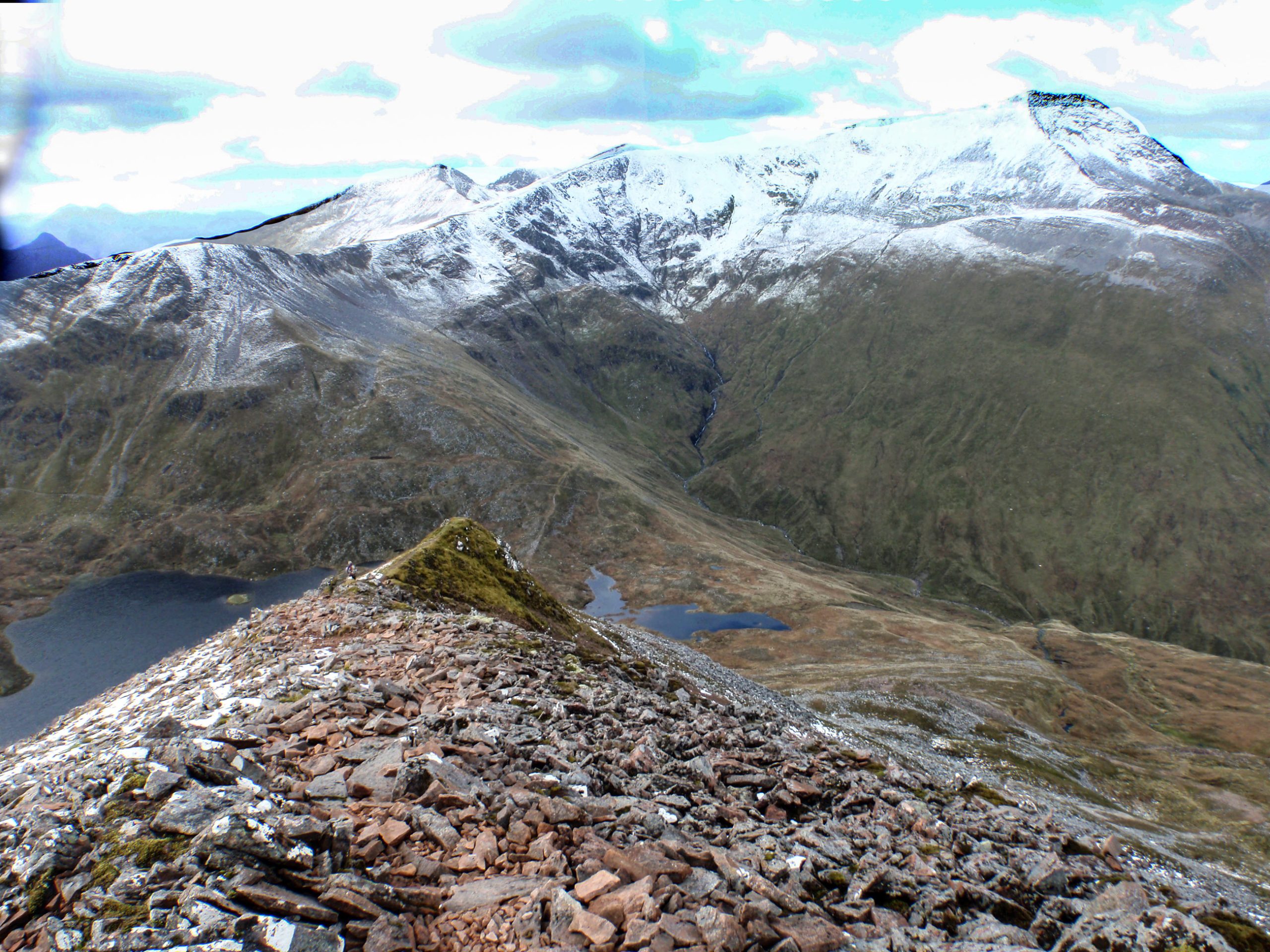
A fine narrow path zig-zagged up the middle of the steep amphitheatre to reach the ridge just to the west of Sgur Eilde Beag. Now in bright sun the views are stunning and the ridge eastwards reaches Binnean Mor. Unfortunately a little late in the day to extend over more tops even though they beckon in two directions.
I dropped down off the north west end of the top to a valley mad with the cries of the deer. From on high I could see a flat piece of land in the bend of a river.
And within 2 hours I had the tent pitched and water boiling for a brew.
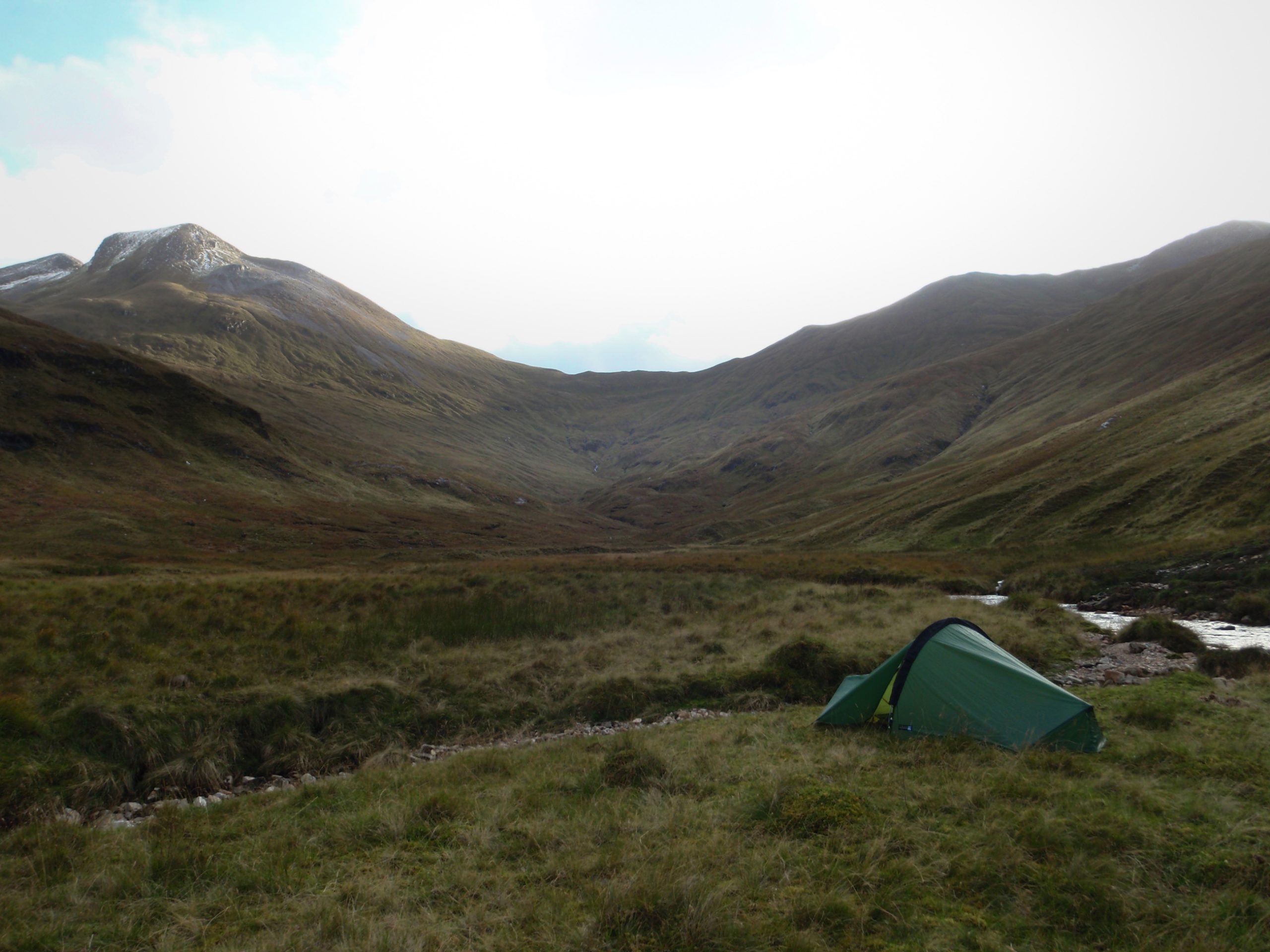
A pathless valley in the Mamores with several flocks of deer on both sides and competing stags calling. Is this the season? I don’t know. But could be an idyllic pitch in dry weather.
Wind and rain makes the Laser Comp feel small. This is my first trip with it since I got a Trailstar tarp a year ago. The Trailstar is a bit large – in the UK mountains there are not so many large level and dry pitches. With the Laser Competition there is not quite room to arrange everything tidily undercover and I find that when I sit up in the night my head sweeps across the surface of the inner picking up lots of condensation.
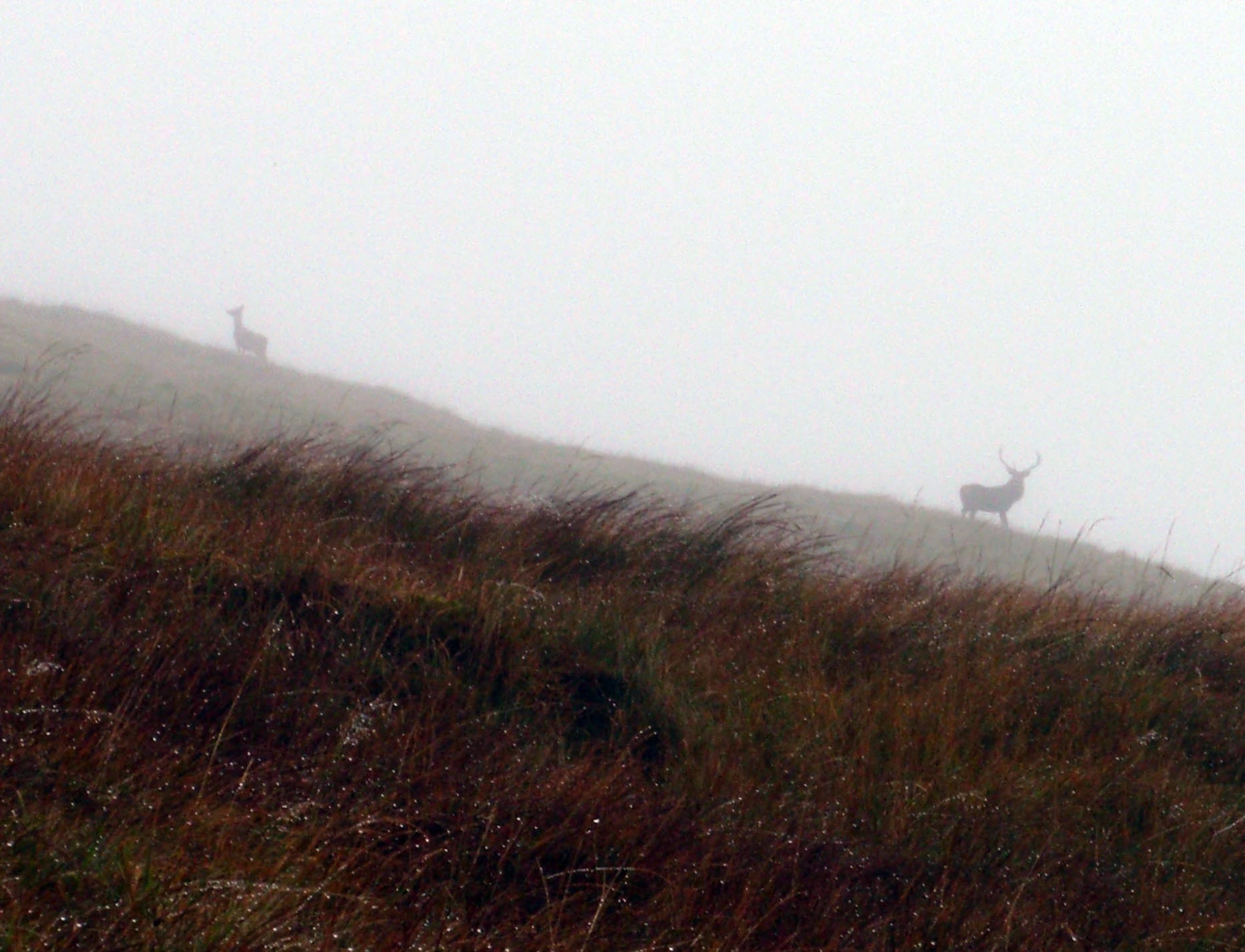
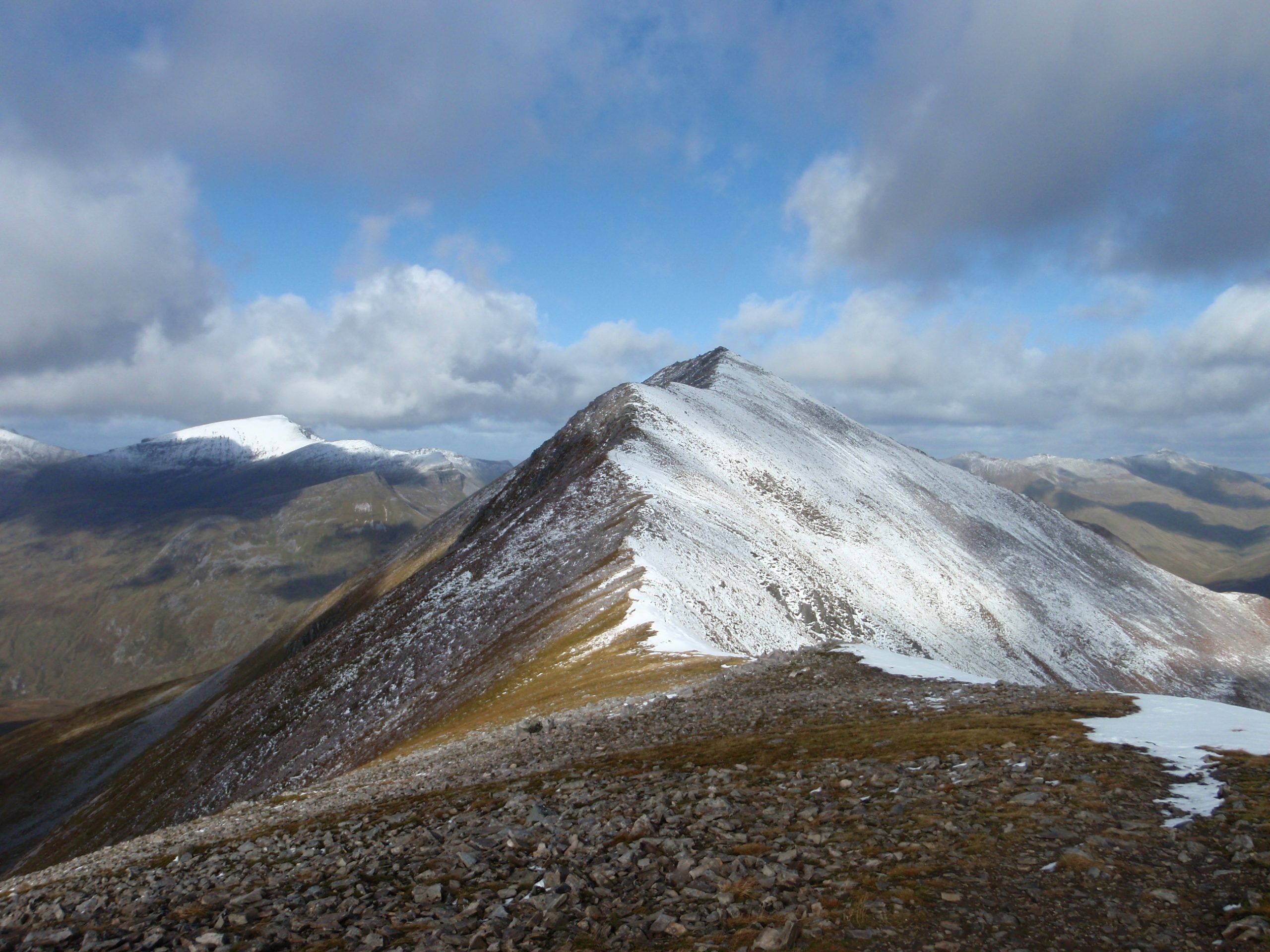
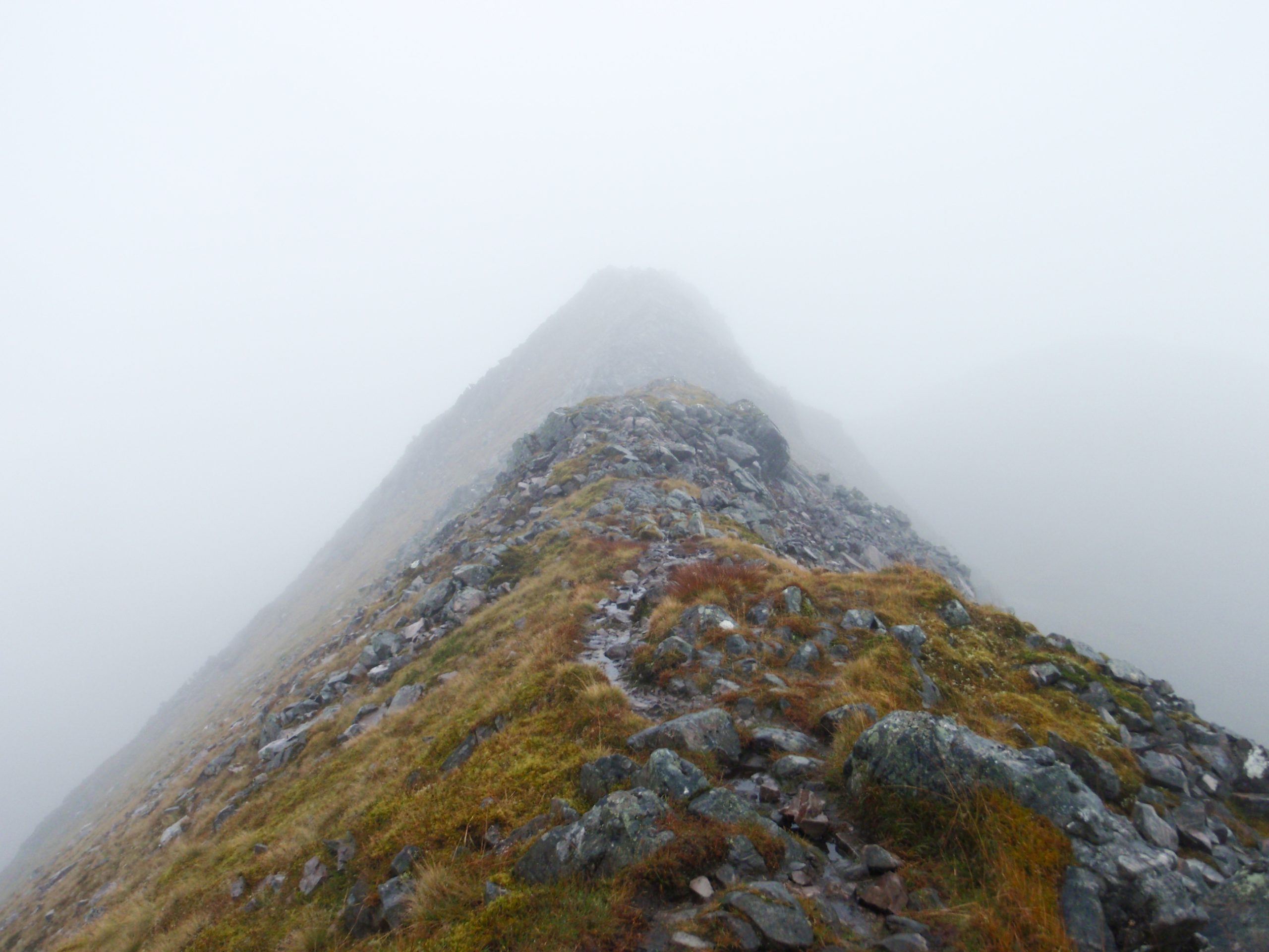
This spot is just below the ridge which starts or ends the Ring of Steal. I scattered the deer as I moved upwards in the morning. Up into the cloud. And drizzle. One peak follows another round eventually to Sgurr a’ Mhaim. I can imagine that this is one of the best walks in the UK. A 10 out of 10. In the mist this becomes just another walk.
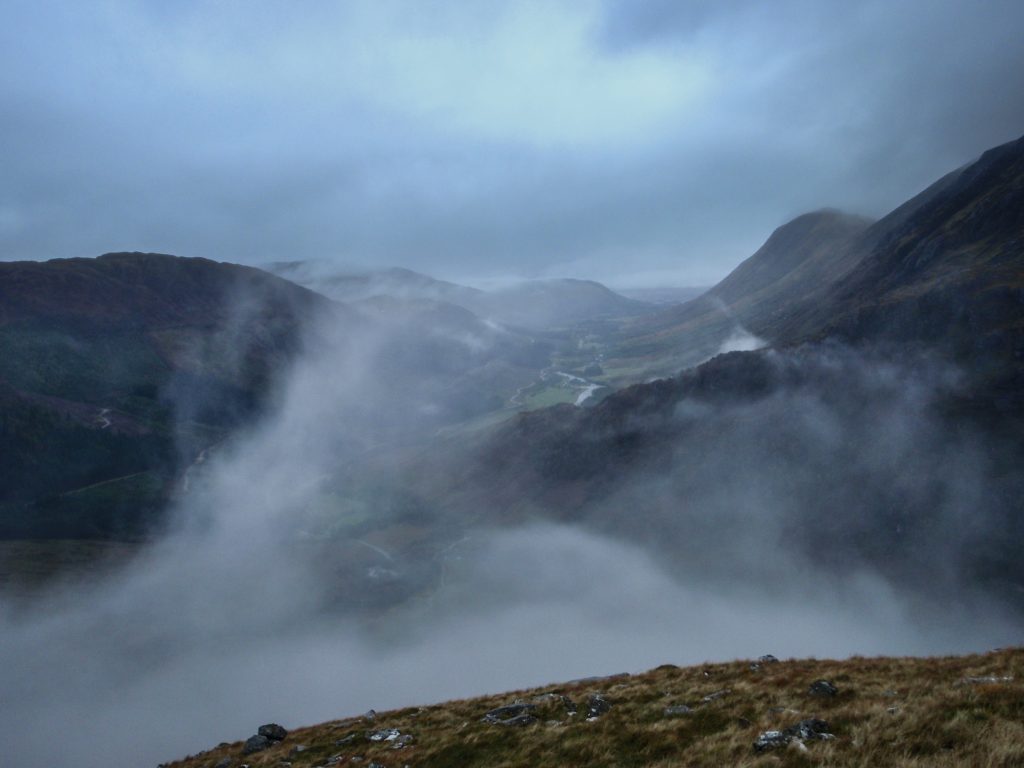
As I came off the ridge the vista opened out below the cloud – and in front of me a large lake in the valley which did not match my memory from the map. A little further and I realised it was a low layer of cloud just above the tree-tops.
Sometimes in the gloaming – after carefully managing my return to civilisation and safety in time – a strange sensation passes over me – brought on by someone rushing in the opposite direction. Today, first a fox with tail outstretched was running up the valley away from the green trees and the sheep, rushing to some widerness hideaway. Then a spectre with a deerstalked hat, and breeches, and a canvass rucksack strode head down through the drizzle, up the valley quite oblivious to my helloa.
The time was getting late, the weather was not getting better. I wanted to camp in the upper part of Glen Nevis, but this must wait for another occasion as I found myself at Lower Falls carpark a few miles further down the valley – and about 5 km from the Glen Nevis YHA.
People are not keen to give a ride to a wet and weary hitchhiker in the area. I was halfway down the road before someone stopped.
I was here once before at the end of the West Highland Way. Things are changing in the SYHA. Now there’s evening meals available, cooked breakfasts, and even beers and wine on sale.
The Glen Nevis Hostel is a homely place but in a inconvenient position. Except for Ben Nevis, that is, because the main path up starts just across the road. Transport links arrive at Fort William however, a few miles to the North; and the interesting hill area is accessed from a few miles in the opposite direction.
A couple of the outliers of the Marmores make a rewarding round from the bottom of road. An hour on the tarmac before heading up through the forest eventually to mount the ridge on the side of Mullach nan Correan. After the forest path ends the haul up the ridge side is tough with a loaded pack and much water underfoot. But once the ridge is gained the steady rise on firm ground made pleasant walking. On this day continuous low cloud obscured all views and made progress very tentative. Every cairn seemed like the top, until another higher cairn was reached.
The ridge round to Stob Ban was more of the same, with just two couples appearing out of the mist as they traversed in the opposite direction. I planned to camp if the weather improved, but this ambition was quashed well before arriving at the top of Stob Ban where the cloud lifted slightly to reveal the landscape below – including the east ridge route down, some of the impressive crags on the NE face, and the stalkers path leading back down to Achriabhach on the road.
As on the previous evening I had walked most of the way along the road to the hostel before someone responded to my request for a lift.
My final day arrived. With low cloud and rain. This time I kept to the valley. I left my camping gear in a bin-bag at the hostel and tramped down the road again, and on to the path to Steal Falls in upper Glen Nevis. Here was a sign pointing to Corrour – the station I had arrived at a few days earlier, just 13 miles away.
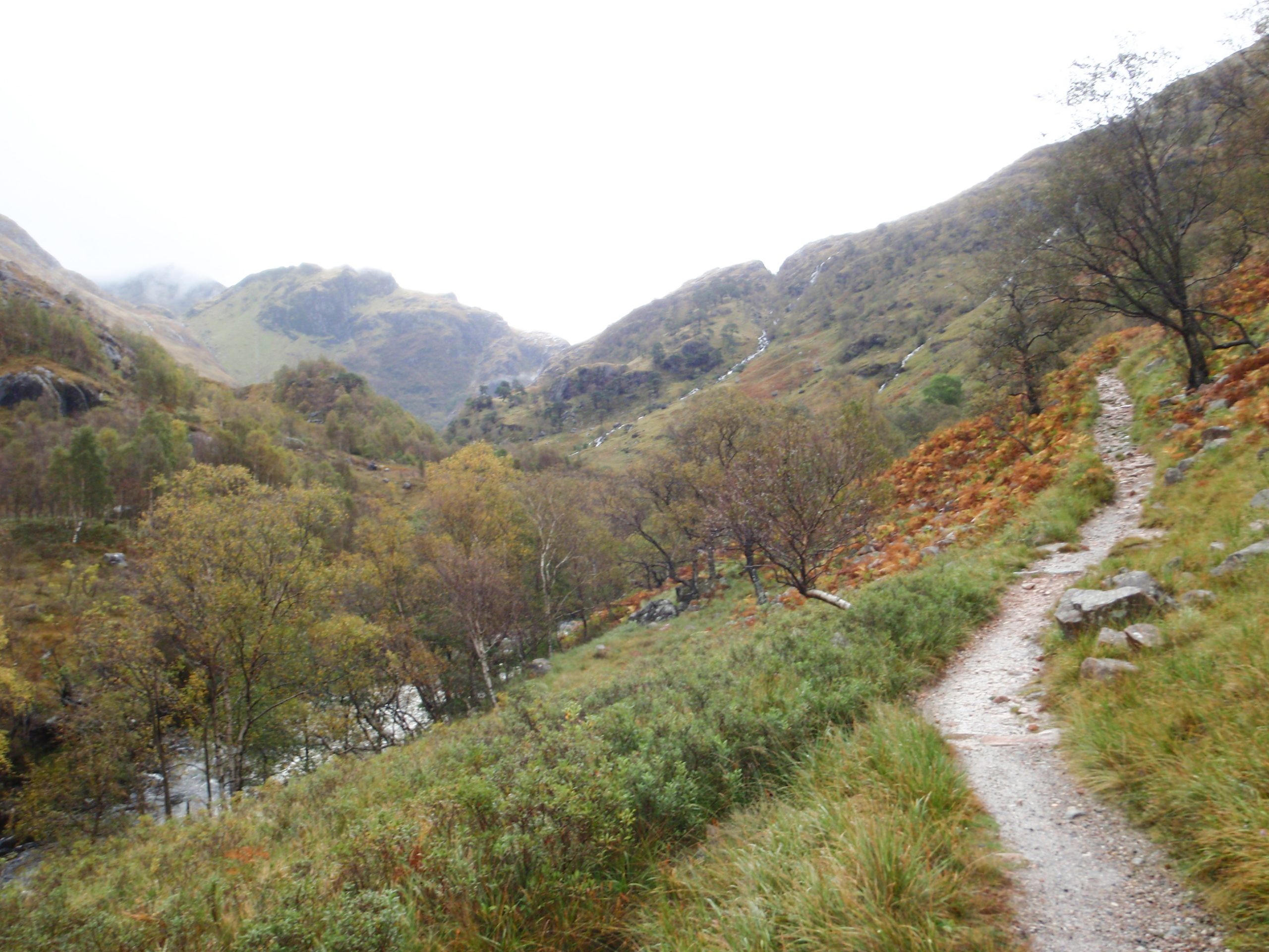
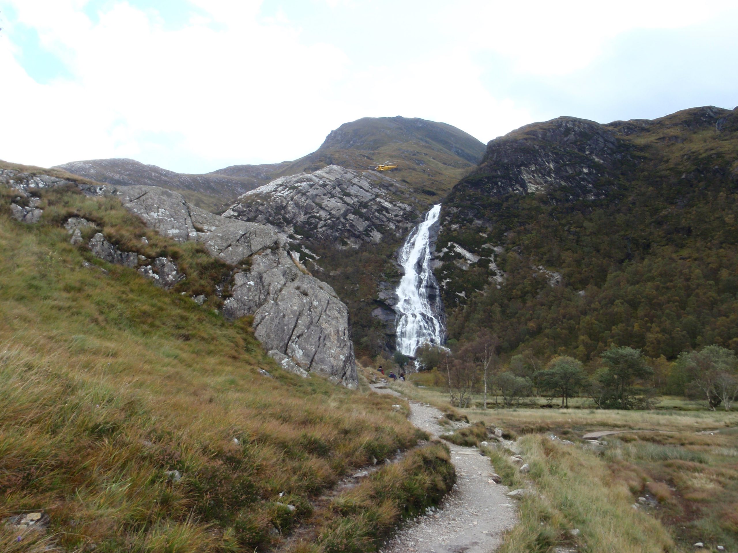
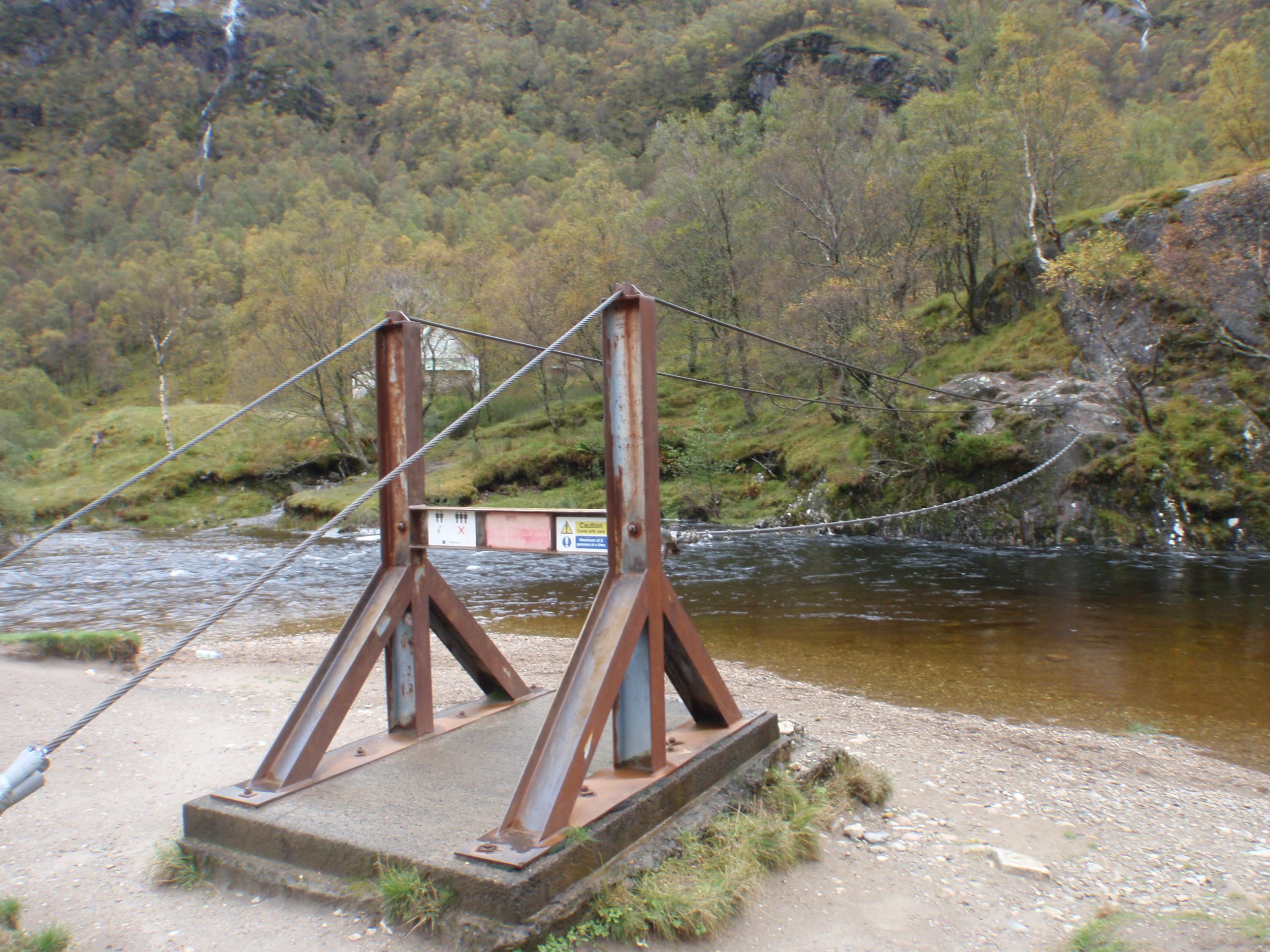
The valley that opens out after the Glen Nevis gorge is charming in every way and a great surprise. Here also is the famous bridge crossing the river which consists of 3 cables – 1 to walk on and 1 for each hand. Not a comfortable crossing for me!
The timing is fine to explore a little, then return down the path and road to the hostel for an afternoon cup of tea. And to pickup the rest of the gear for the walk down to Fort William and the night train.
Right next to the station is a giant Morrisons supermarket. After collecting wound dressings from the nearby Boots the Chemist for the repair of my feet, it was impossible to resist a fish and chip supper in Morrison’s cafe. And so to join the cheery crowd in the lounge car for a few beers before rocking to sleep on the bunk bed in my compartment. Ready for work the next day.
This is a great hike and good training for the TGO Challenge. See here!
There’s other similar mountain hike trips described on the blog. For example see here!
Could you be so kind and recommend other sources that carry info on this topic of course just in case you are aware of some.
My best book sources are Chris Townsend's Cicerone 'Scotland' which has fairly comprehensive coverage of the uplands, and Ralph Storer's books on the paths and tracks between the mountains.
If you want online information then investigate those who blog about the TGO challenge. This yearly walk covers this landscape and more.