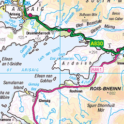
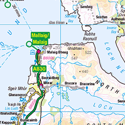
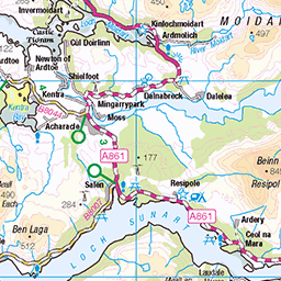
This is the route for my walk across Scotland in May. The detail has been updated following comments from the Expert Vetter at Challenge Control.
Unfortunately the links to the OS Maps planning tool don’t work reliably, but thankfully Skirrid Systems’ plugin for WordPress continues to work well!


Leaflet Contains OS data © Crown copyright and database rights 2025
| Page 1 | DAILY ITINERARY WITH FOUL WEATHER ALTERNATIVES (if needed) | DISTANCE (km) & ASCENT (m) | OVERNIGHT HALT (name & grid ref.) | |
THU 9th MAY | Path NW from Lochailort station to Gleann Mama. E. alongside Loch and beyond to join path northwards Meoble. E. on Slaite Coire to Lochan Bhrodainn. | 18 | 1050 | Lochan Bhrodainn NM 837 872 |
| FWA: Road A861 E to Arieniskill. Path E. and N to Meoble, then E on Slaite Coire. Descend to Oban bothy, continue W into Gleann an Obain Bhig for 2km to camp spot. | 10 | 800 | NM 888 895 | |
FRI 10th MAY | Ridge Cruach Bhuidhe, Sgur an Ursainn, Beinn Gharbh E, Sgurr nan Coireachan, Meall an Tarmachain, Beinn Gharbh W, Sgurr Thuilm, & NE over Meall an Fhir-eoin. Cross Gleann a Chaoriann heading SE over low point of ridge to E. to Gleann Camharaidh for camp near Fraoch Mor / Gualann nan Osna | 20 | 1800 | Gualann nan Osna NM 992 875 |
| FWA: From Gleann Oban Bhig, W. to Glenpean and through woodland to cross bridge S to Gleann a Chaorainn. heading SW over low point of ridge to E. to Gleann Camharaidh for camp near Fraoch Mor / Gualann nan Osna | 14 | 870 | same | |
SAT 11th MAY | Ascend ridge to W Gulvain. Follow ridge over Mullach Coire nan Geur-oirean to bridge at Invermallie. Lakeside track W to road B8005. N into Glean Cia-aig to camp at river junction with Allt Tarsuinn. | 25 | 1130 | Abhainn Chia-aig / Tarsuinn NN 188 928 |
| FWA:S. To follow Allt Choire Reidh to Gleann Fionnlighe. NE to Glen Mallie, then track towards Invermallie and lochside track W to road. Glean Cia-aig as above. | 30 | 600 | As above | |
SUN 12th MAY | E. onto ridge. Meall Oddhar, Meall na Teanga. Sron a Choire Gharbh, S & E ridge San Mheall and Meall nan Dearcag. NE then through woodland to join track by Kilfinnan Burn. Killfinnan to Laggan locks to hostel at Laggan. | 16 | 1240 | Laggan Hostel |
| FWA: NE on track to building Fedden, E. to join track All Cam Bealich, then Allt Glass-Dhoire to S. Laggan Forest. Track to Kilfinnan. As above. | 14 | 410 | As above | |
MON 13th MAY | SE through forest via Coire an Sidhein to ridge and descend via Allt Teanga Bige to Glen Turret and tracks to Turret Bridge and Annat.Path S. along Burn of Agie to high camp at Loch Uaine. | 21 | 1350 | Lochan Uaine NN 418 883 |
| FWA: | ||||
TUE 14th MAY | E. on ridge Puist Coire Ardair. View point E. at Sron A Choire & return W. to Creag Meagaidh. S. ridge Creag na Cailliche. SW. then SE descend to outflow of Lochan na Caillich. E on road, bridge S. at Luiblea. Track S. to end of Beinn a Chlachair W. ridge. E along ridge over summit. Descend N. to join path skirting Geal Charn to camp spot between two segments of Lochana-Earba. | 34 | 1540 | Loch na h-Earba NN 495 845 |
| FWA: from Lochan Uain W., then S.. to Tom Mor and Allt a Chaorainn. E. on forest track to S side of lochan na Caillich. S. to road and bridge at Luiblea. Track S & E to Lochan ne H-Earba and camp spot. | 28 | 370 | As above | |
WED 15th MAY | Track NE alongside lochan, then SE to join S-N route along river Pattack. Bridge at NN 554 868. Path E. to waterfall then due E between 589 and Meall nan Eagan to follow outflow E to join track SE along Allt an t-Sluic to road A889. Track / road to hostel at Dalwhinnie station. | 21 | 320 | Dalwhinnie hostel |
| FWA: | ||||
THU 16th MAY | S on main road to bridge at NN 637 840 then NE on track by aqueduct to Loch Cuaich. Follow Allt Cuaich on track E. At Loch Cuaich continue E and ascend W edge of Bogha-cloche. E. then S onto Sgor Dearg. Level path E then steep down to Gaick Lodge. Track then path SE beside Allt Gharbh Ghaig to waterfalls at Bruach Gharbh Ghaig. Join path to E thrn S on Feith Ghorm Ailleag to Glen Bruar. Camp spot at river junction. | 27 | 950 | N. Glen Bruar NN 819 803 |
| FWA: S on main road to bridge at NN 637 840 then NE on track by aqueduct to Loch Cuaich. NE pass loch Feith na Brachlaich to Allna Feinnich to Bhran Cottage. Cross bridge to E. and track to Gaick Lodge. | 33 | 700 | As above | |
| Page 2 | DAILY ITINERARY WITH FOUL WEATHER ALTERNATIVES (if needed) | DISTANCE (km) & ASCENT (m) | OVERNIGHT HALT (name & grid ref.) | |
| FRI 17th MAY | E on Allt a’ Chuil over watershed to Tarf water passing Loch Mairc continuing E to bothy. Cross Feith Uaine, E along Tarf Water to join track at building, then SE to river Tilt. S to bridge at NN 956 763. Cross and follow river bed to Bealach an Fhiodha. E. to ridge Airgoid Bheinn and Carn nan Gabhar. N. ridge over Meall Gharran to river junction at Tilt / Lochain for camp spot. | 32 | 1270 | Tilt / Lochain Sheilings NN 980 782 |
| FWA: As above to river Tilt. N alongside Tilt / Garbh Buidhe to nearby Loch Tilt for camp spot. [note recover to main route on 18th :- SE to join track between Meall na Caillich Buidhe and Meall Chrombaig leading to Feallar Lodge then path SE to bealach by Carn an Righ as below 8km 500 m ascent] | 25 | 500 | Loch Tilt NN 999 826 | |
| SAT 18th MAY | Cross An Lochain E to ridge and Creagh Dhearg. Path / track E to Gleann Mor then S / SE following river to SE bealach. Ascend Carn an Righ returning to ascend Beinn Lutharn Mor. SE. to Loch na Eun, then NE to An Socach. Ridge E then N. descending from point ‘855’ to track and bridge N of Altanour Lodge. Follow Ey Burn to find camp spot. | 25 | 1550 | Ey Burn NO 102 846 |
| FWA: As above to below bealach. E. to Loch na Eun. N. to path/ track beside Allt Beinn Lutharn to reach same camp spot by Ey Burn. | 20 | 720 | As above | |
SUN 19th MAY | Track Glen Ey to Inverey. Forest track / road / track to Tomitoul to Braemar. Leave to E past church and school via ‘Lions Face’ to join A93 above river. Before Inercauld Br right into forest with track heading S. At Glenbeg burn find camp spot. | 21 | 400 | Glen Beg NO 190 889 |
| FWA: | ||||
MON 20th MAY | E. on path to join track S along Feidallacher Burn to Carn an t-Sagairt Beag, E to Cac Carn Mor Lochnagar. Skirt crags to Meikle Pap and E to track leading to Spittal of Glenmuick. SE to Shielin of Mark. E. and slightly N. over Earn Stone to descend to Glen Mark and camp. | 30 | 1290 | water of mark / craig doune NO 390 834 |
| FWA: tracks and paths E skirting hillside to Gelder Burn crossing. Then track S. to Spittal of Glenmuick. From here as below. | 30 | 950 | ||
TUE 21st MAY | Track S. along Mark crossing to Invermark Lodge & Kirkton cross Waters of Lee. Track on S./ W. side of river Gleneffock, Dalbrack, etc until Keenie. Cross burn then right to rising path S. over Hill of Wirren & East Wirren, Black Hill descending to Tillydovie. Cross river below farm and camp nearby. | 33 | 730 | Lundie NO 565 688 |
| FWA: As above, follow minor road E then SE from Tillydovie for approx 3km to find bridge beyond carpark on right NO 577 688. Camp nearby. | NO 577 688 | |||
WED 22nd MAY | Track / road Lundie Mains, Inchbare, Dun, Bridge of Dun, Lurgies, A92 to Montrose. | 26 | 190 | |
| FWA: | ||||
