T was keen to revisit his youth! He had worked as a gillie on an estate while a fresh-faced student. He ran up and down the pathless hills to manoeuvre deer towards the hunters. On his days off he took free and walked to The West reaching the edge of that blank part of the map known as Knoydart.
Now 60, he remembered that this was where he wanted to explore and satisfy his curiosity – to see over the last hills and down to the western shore.
Confiding this to a TGO-er means it will not remain a dream for long. As soon as a tentative date was agreed a plan was made.
A TGOer has a packing list available at the slightest hint of interest, and a methodology for route planning. Some TGO credentials can be reached here!
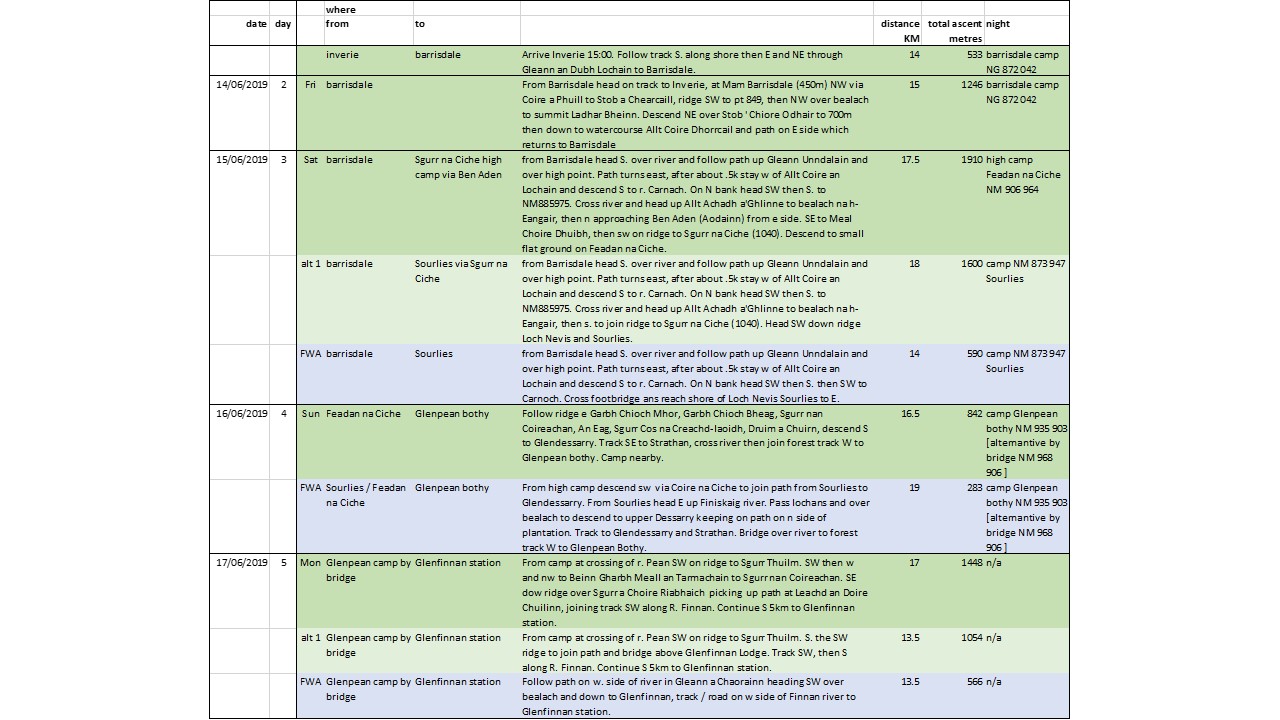
For route planning there’s the ‘Optimistic’, the ‘Optimal’, and the ‘Foul Weather Alternative’. The TGO requires just two of these, but this time I felt we needed all 3. These are:- i) the route I wanted to do (darker green in the plan); ii) a fall-back in case we were having difficulty (in lighter green); and of course iii) the foul weather route to be used in case of emergencies weather-related or otherwise (in grey).
The year is 2019 and I do not have a place on the TGO. Knoydart though will provide a taste of what I was missing!
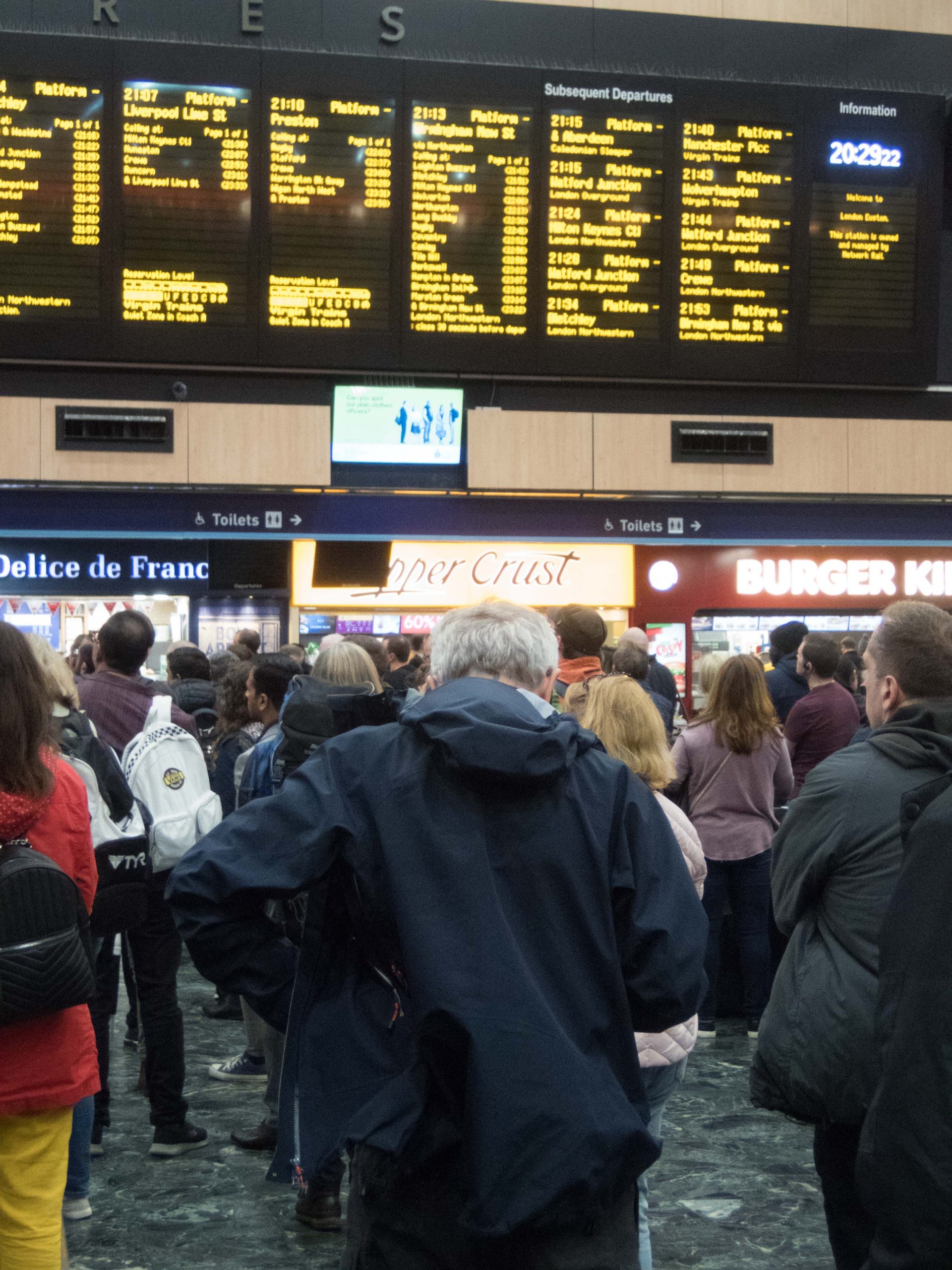
The special way to Scotland from the South is the night train, and for this trip we were promised brand new luxury carriages. Many years in the coming, these would replace the oldest of old rolling stock. There was a price to match this high spec and we were looking forward to leaving the gloom of a London commuter station behind as we entered the new accommodation. Down on the platform was a rude awakening. Carriage after carriage, all 16 of them were as ancient as anything at London Euston station on that evening!
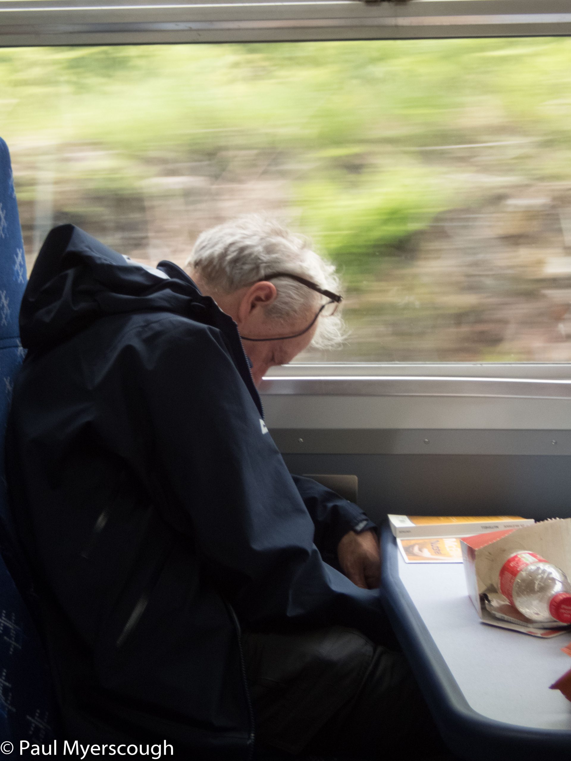
So we followed the old routine – struggling through the narrow corridor to deposit our packs in the tiny cabin before rushing down to the lounge where we knew we would be comfortable for a few hours with food and drink.
The night is spent shunting around in darkness until eventually there is something to see out of the window. Time to take to the lounge again, looking for flocks of deer set against a panorama of mountains.
Fort William is as far as you can go – only two of 16 carriages arrive here – and berths can be hard to come by. Next we will take the local line to the end stop, Mallaig where we pick up a boat across the loch to Knoydart.
Fort William station is buzzing and there’s a train that does not appear on our timetable. The carriages are even older than the ones we arrived in. This is the ‘Jacobite’. A steam train fully booked with enthusiasts and Harry Potter fans.
An hour or two later we follow on the scheduled service. It was good we had reserved seats, but unfortunate that a group of people even older than us were sitting in them. Why? Because another group – of American school kids – were sitting in their seats. Ah well, eventually the elders prevail!
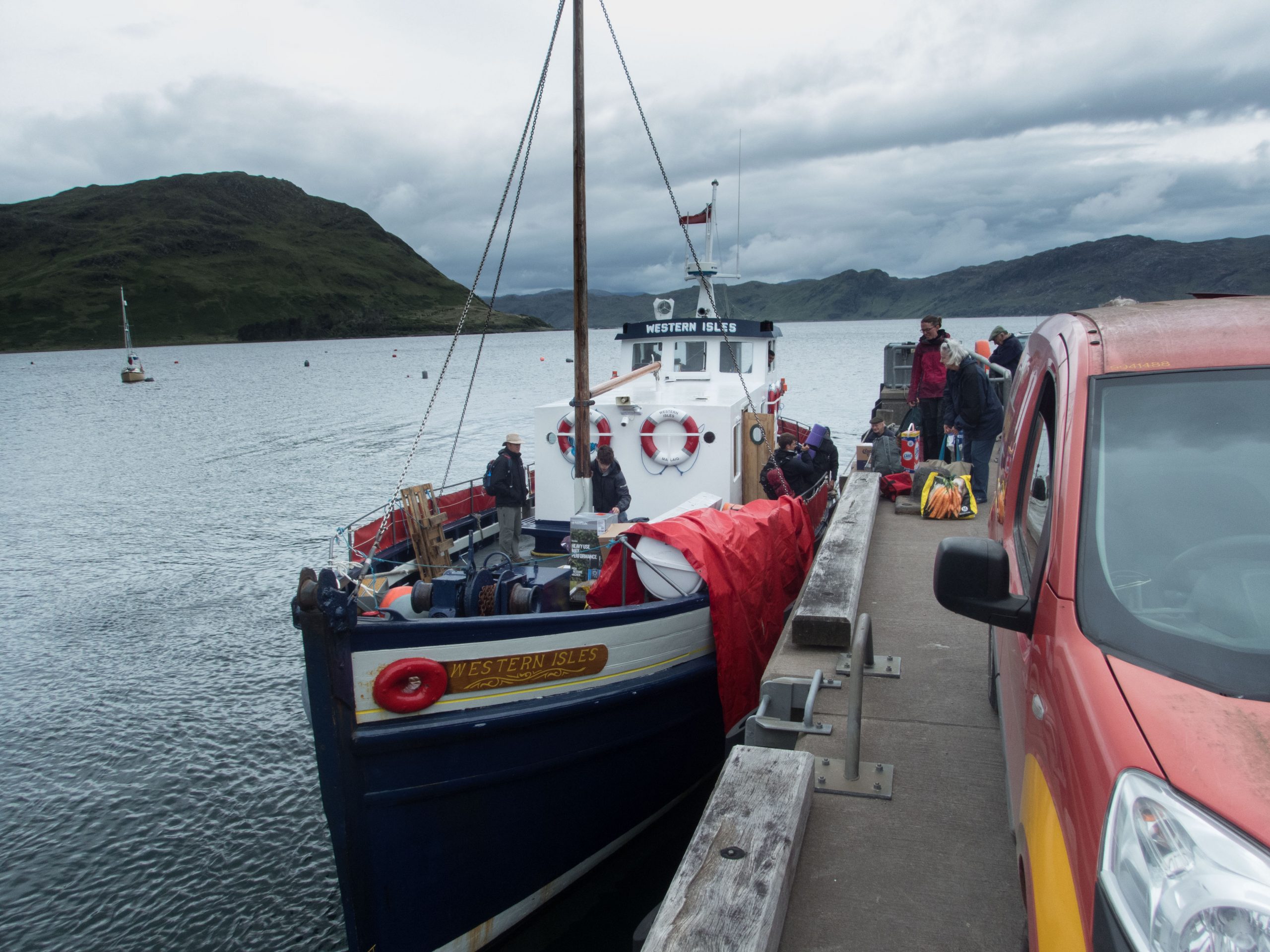
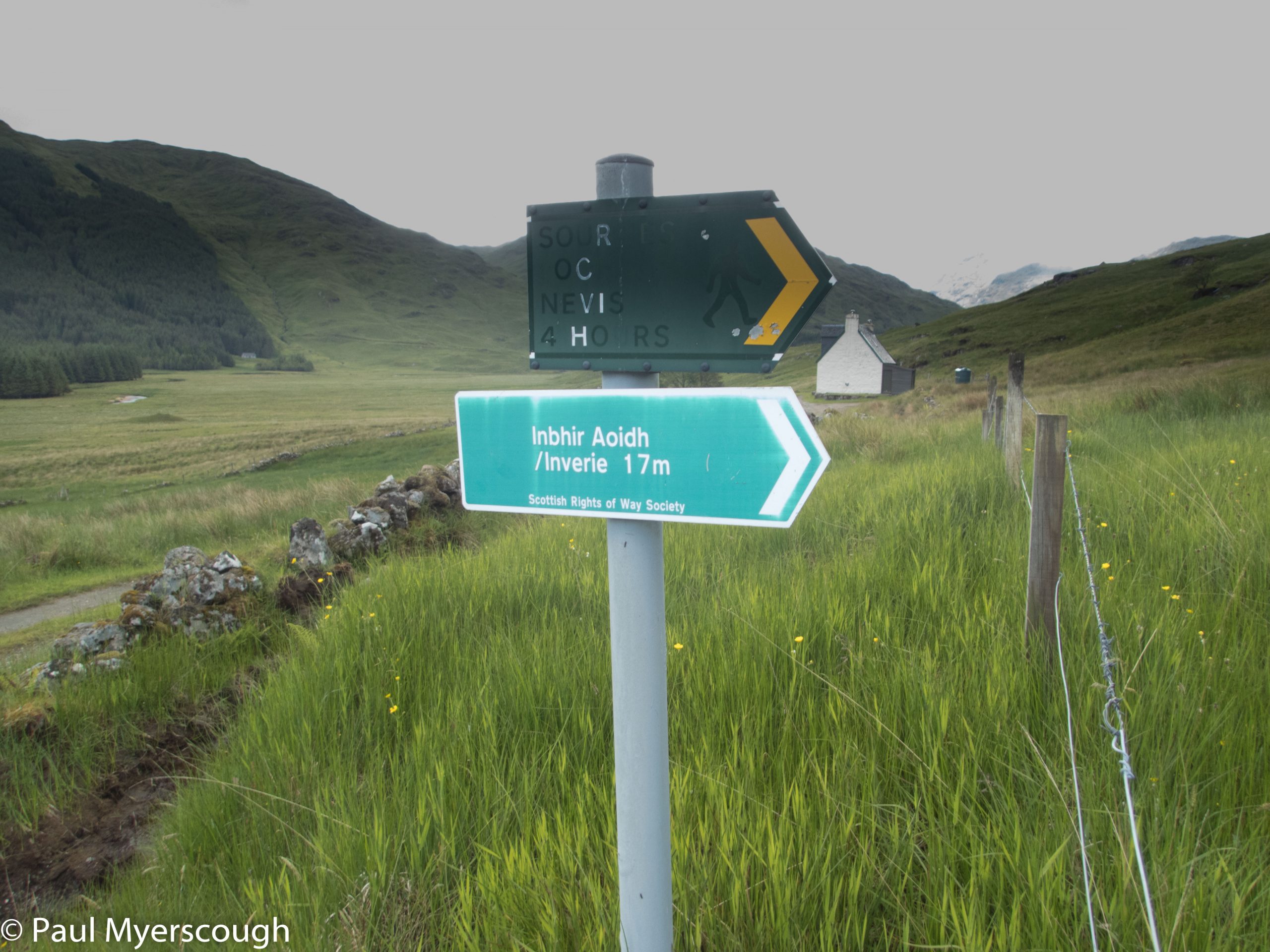
Mallaig is the end of the line. A small, busy fishing port with ferry services to Skye and some of the islands. Close to the station is also the boat that will take us across loch Nevis to Inverie on the Knoydart penisula.
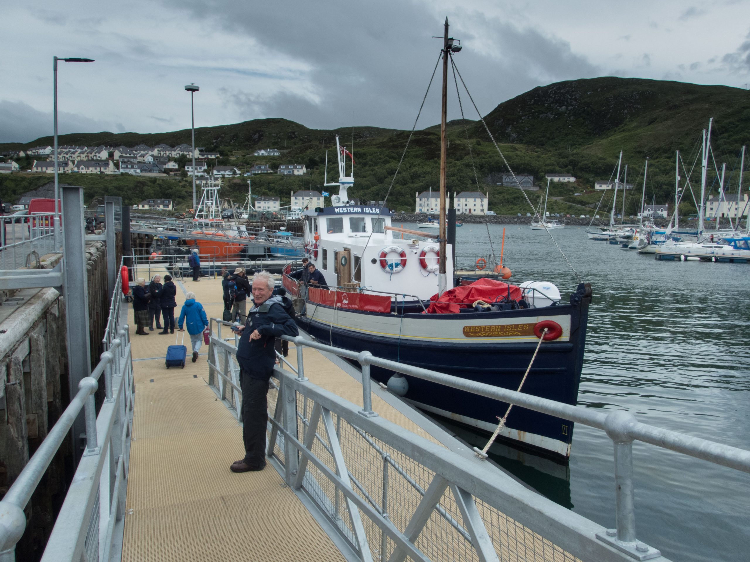
The timing is fine for a 3 or 4 hour walk across to Barrisdale where we will camp for the night.
Download file for GPSThe map above shows our route recorded by my Spot Tracker. This sends our coordinates every 30 minutes to satellites up above. Spot also serves as an emergency beacon in case of trouble with direct contact to the rescue services. A web service from Social Hiking captures the information so folks at home can follow our progress on a map and the coordinates can be reused here.
The map can be zoomed in and out and dragged around within the window to explore the route tracked over the 5 days.
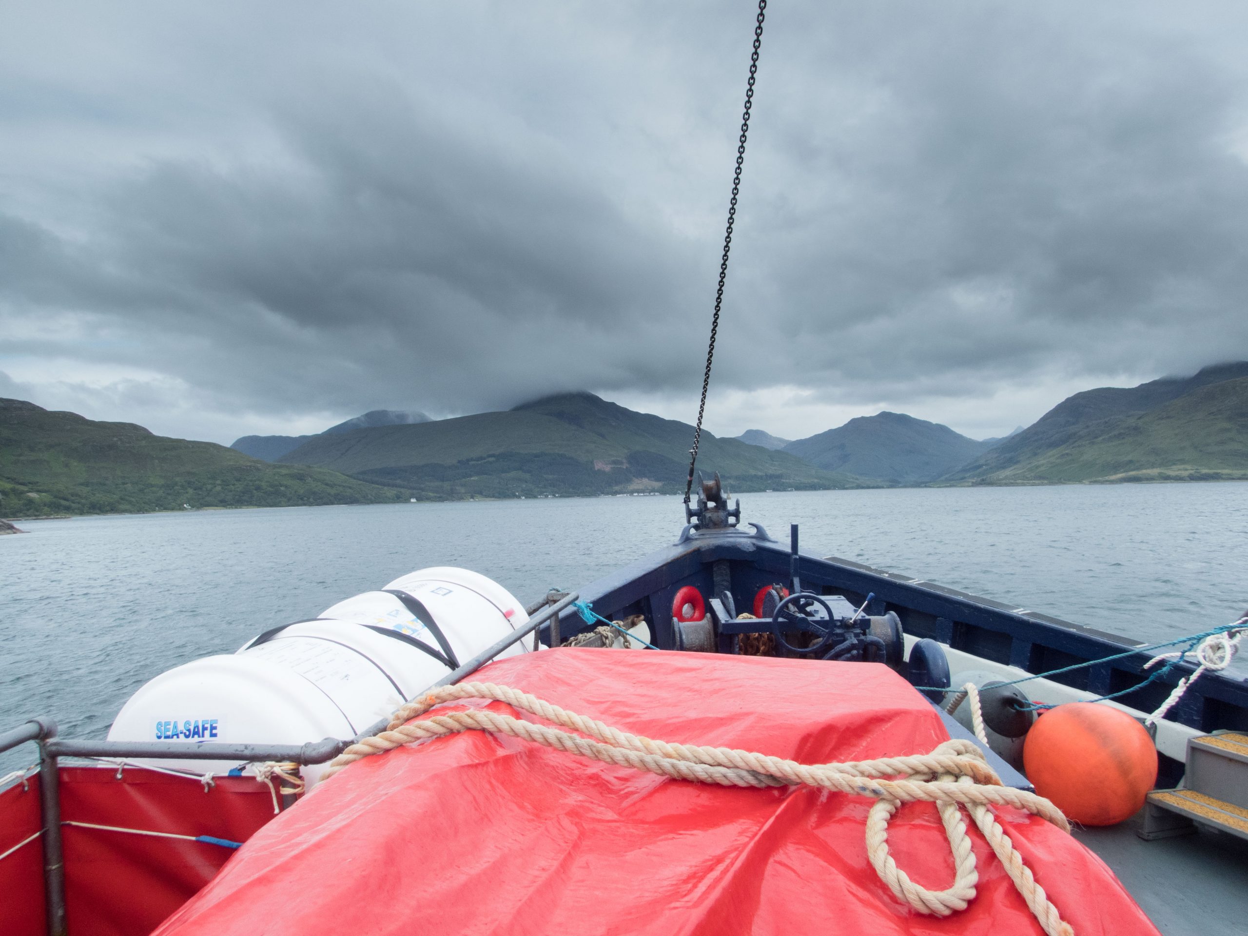
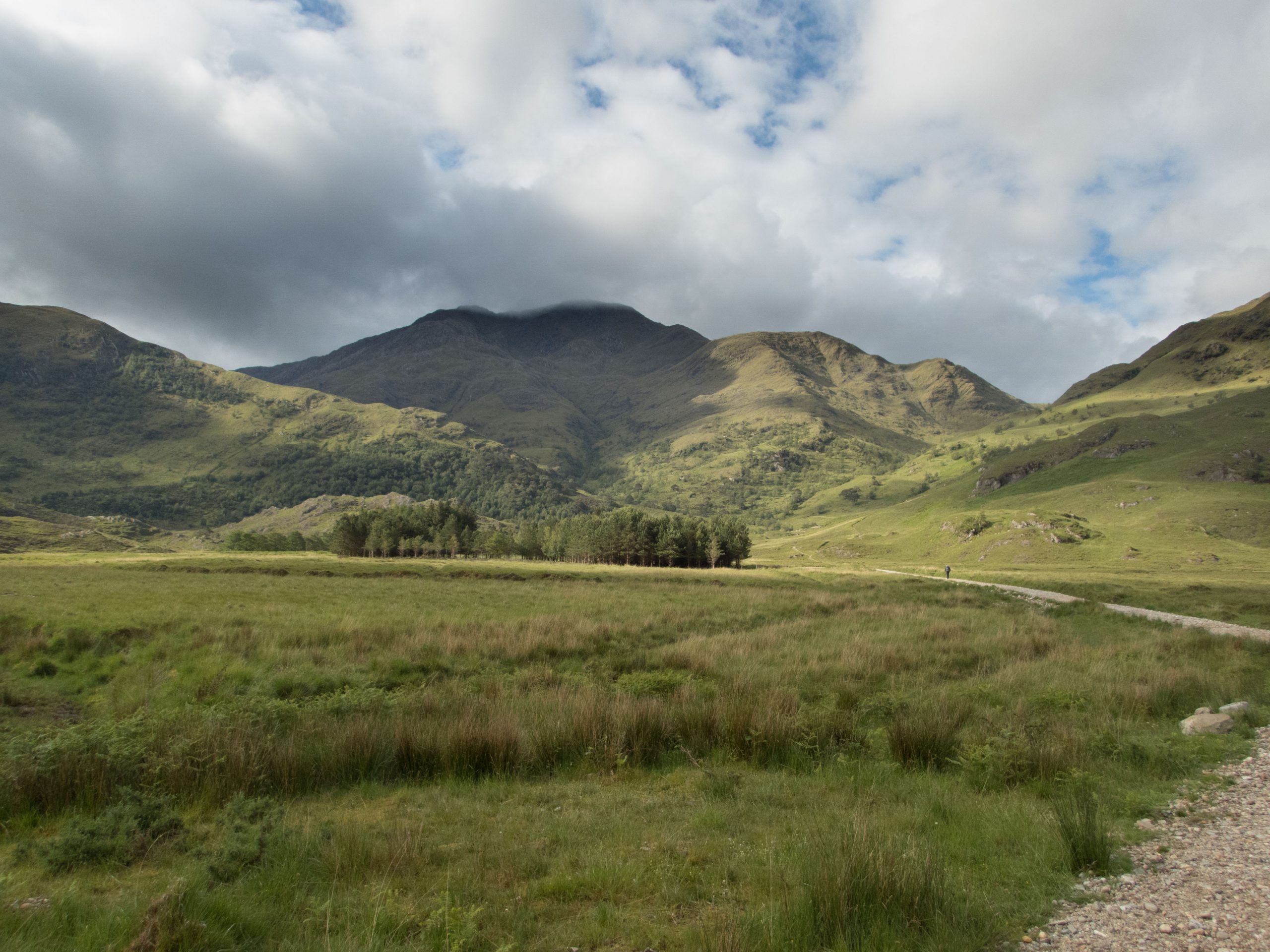
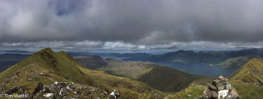
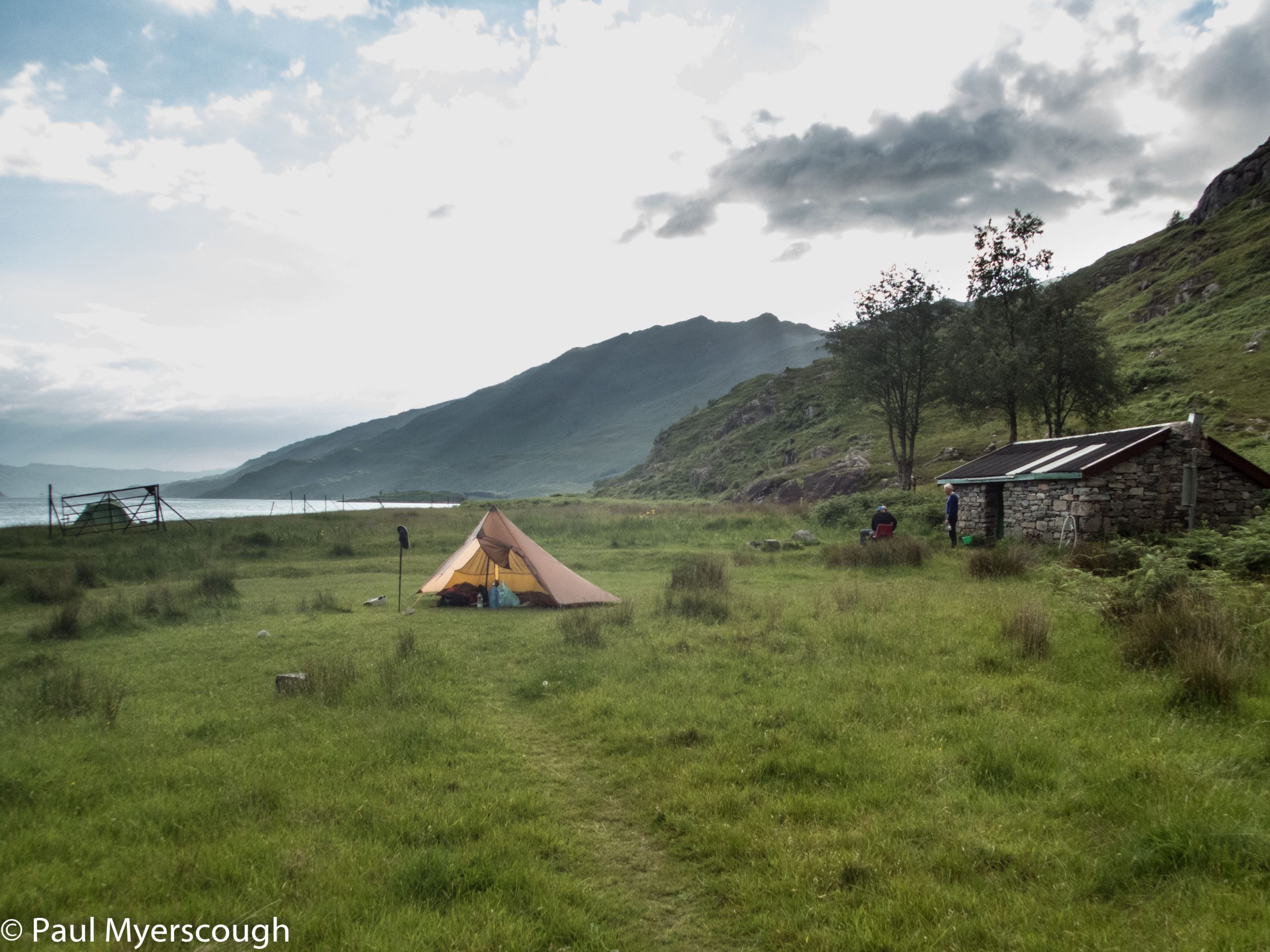
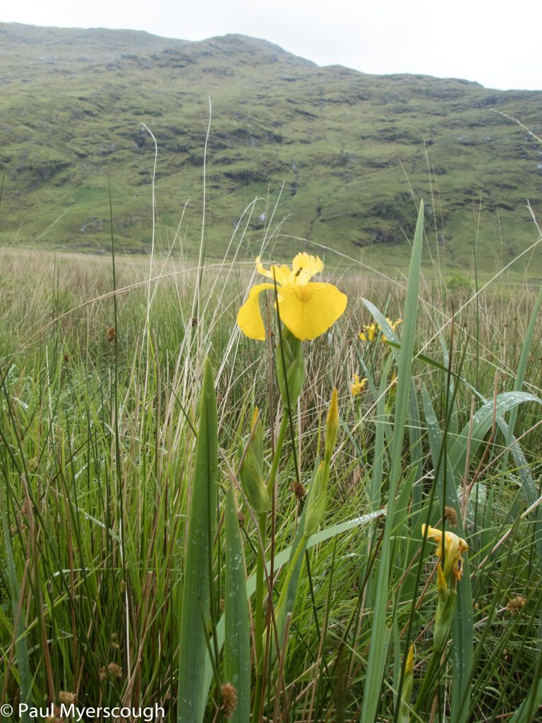
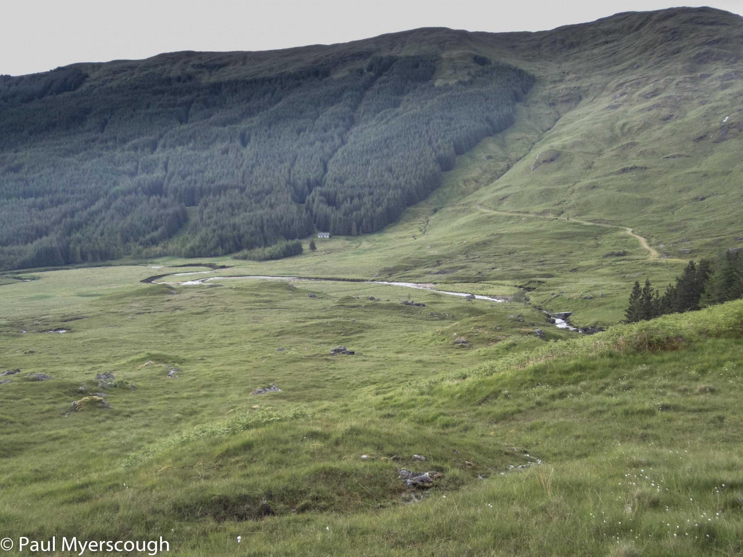
Looking over Loch Hourn, Barisdale is an attractive and remote location. In all directions there are mountains. I have passed through several times before, always thinking about returning to walk the hills nearby.
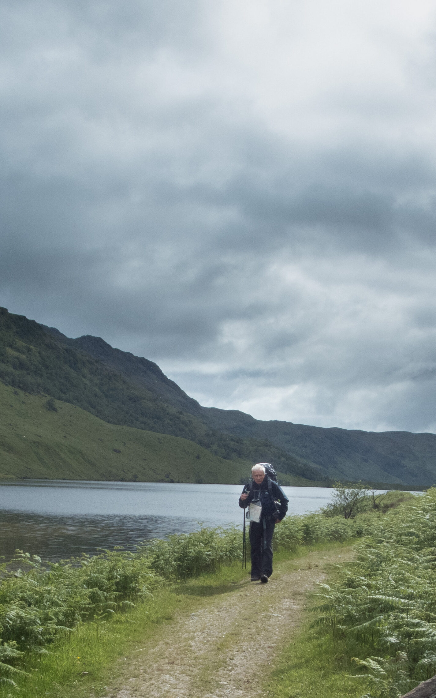
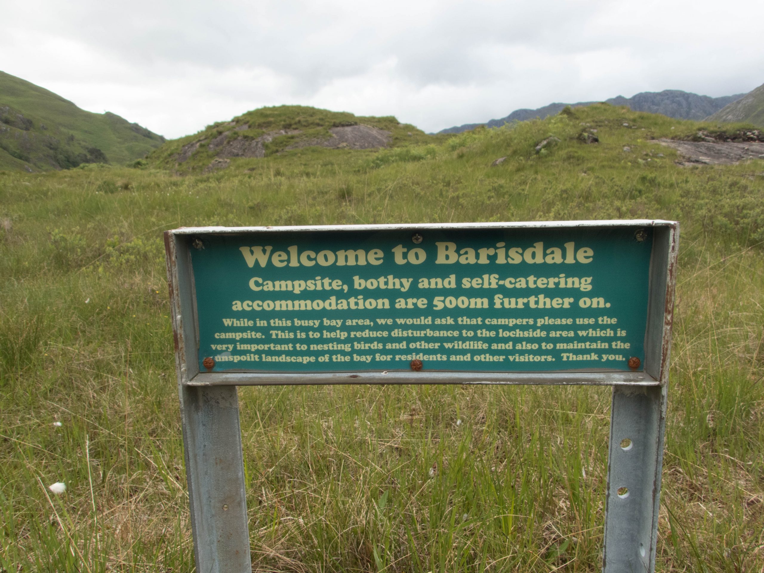
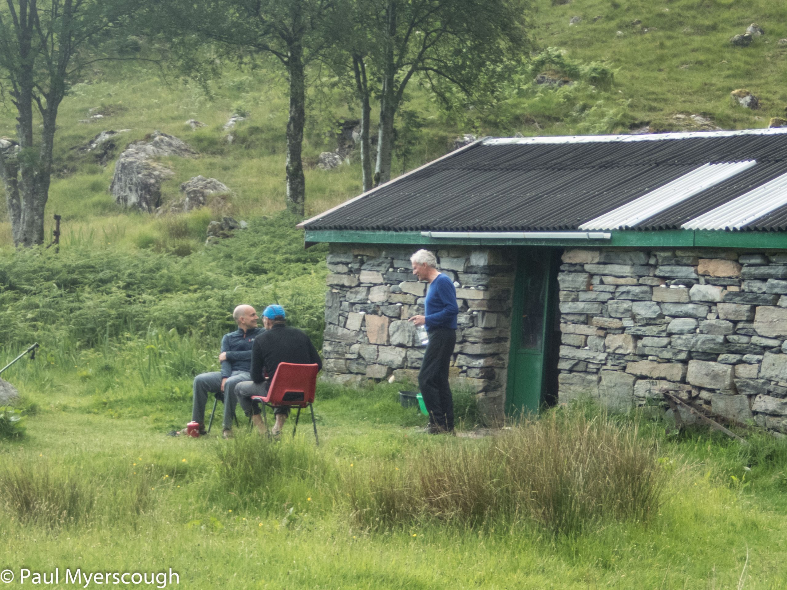
It was after 7 when we arrived to set up camp, but there were still some hours of daylight left on this sunny June evening. An area of flat ground is reserved for tents across the track from the bothy. This building provides a toilet (luxury!) and a ‘kitchen’ with running water where we could set up our stoves away from the weather outside. Campers pay £5 per night, probably the same as those using the bothy. A couple of unattractive sleeping rooms did not tempt us from our tents despite the midges outside.
The 4 hour walk was enough of an introduction to the hills for one day. And we soon saw why the other two campers here were zipping up in their tent after their meal. The midges were voracious! A quick meal for us in the gloom of the bothy and then – a deep sleep of recovery was in order.
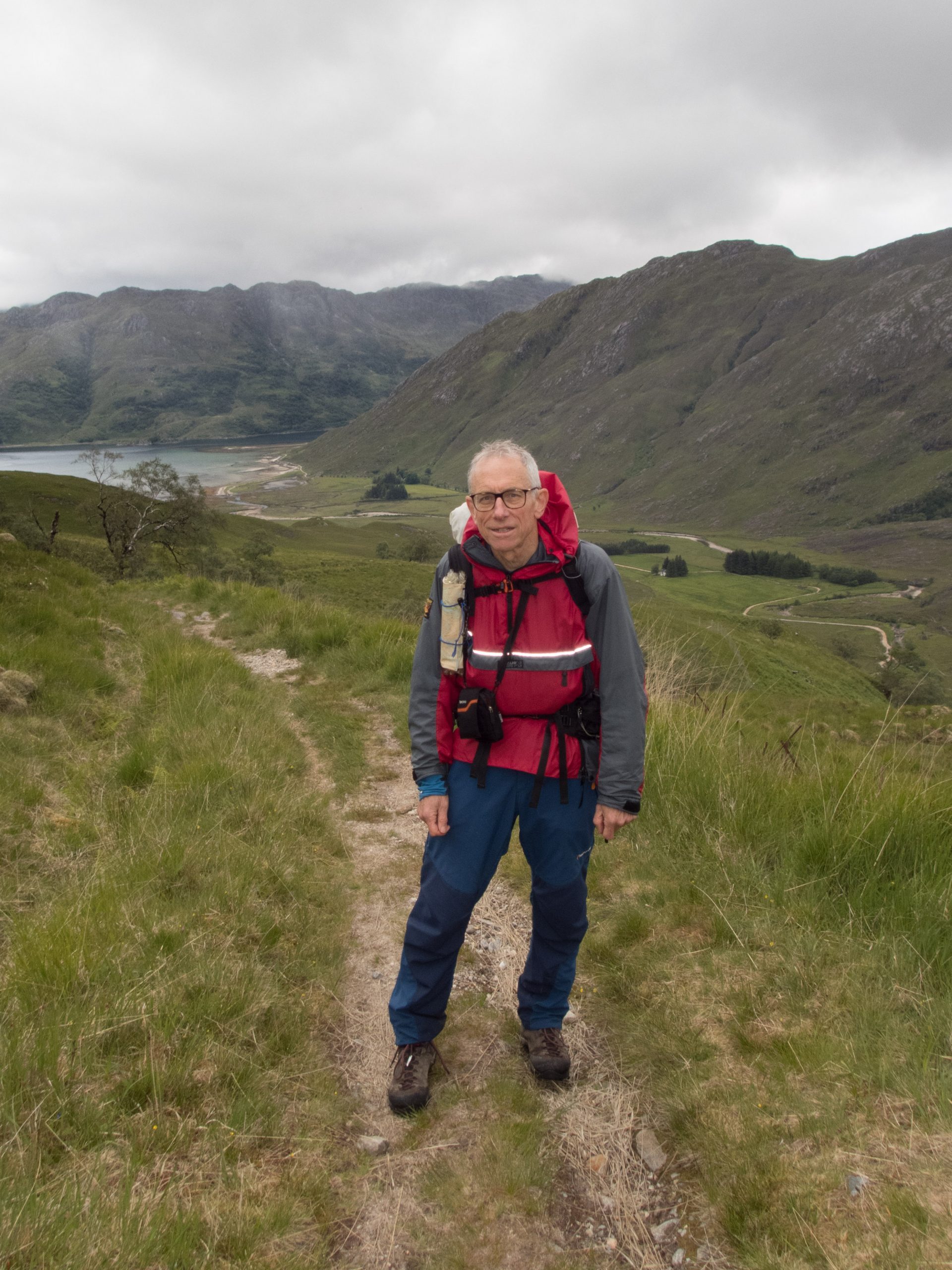
Before departure we modified the plan so that the first day could be done without a fully loaded pack. Finding our pace and fitness level without the pressure to get to a fixed destination seemed a good idea, and this was reinforced by our performance walking over from Inverie.
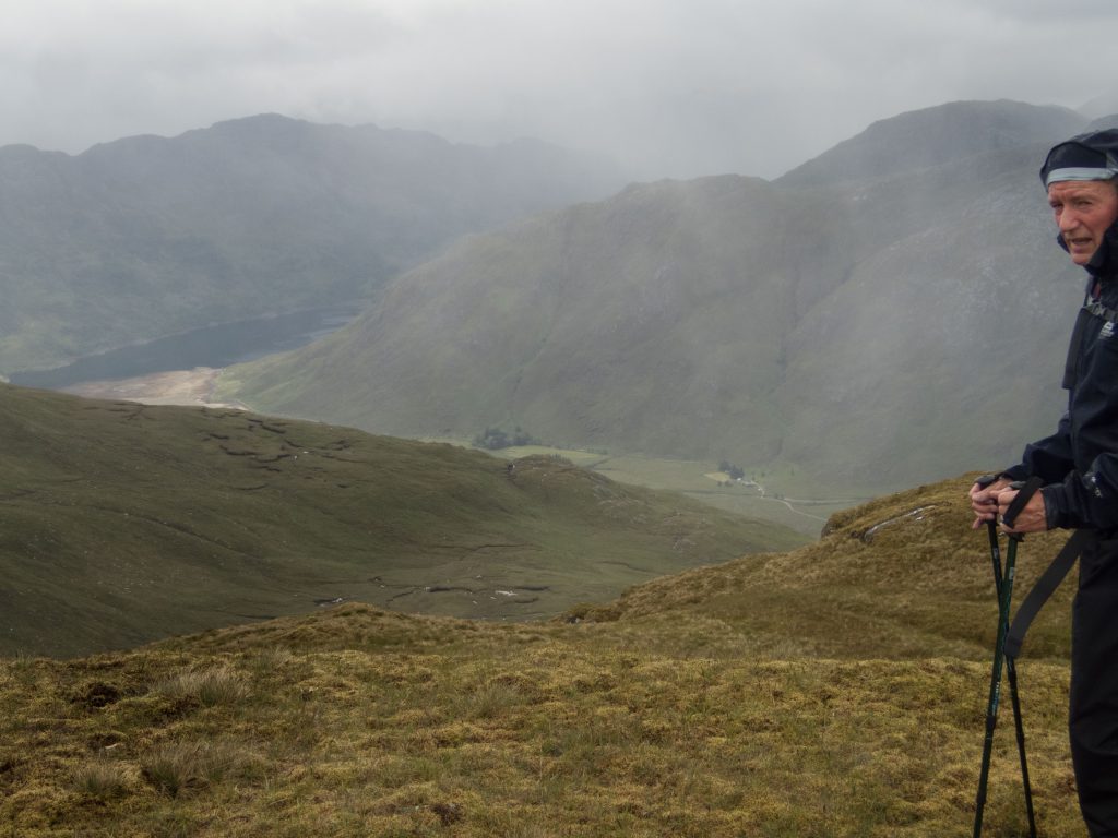
We woke to a fine morning. A small breakfast, and we were ready for the first test. Each day I hoped to walk high on the ridges, but maybe we were not fit enough. Even if the whole of the rest of the trip was in the valley bottoms at least today we will go high!
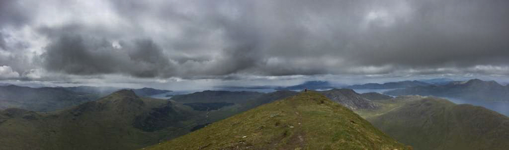
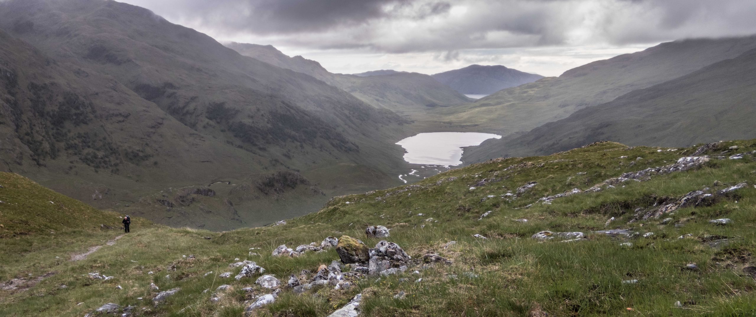
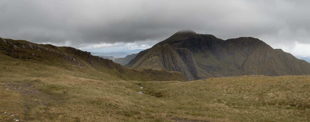
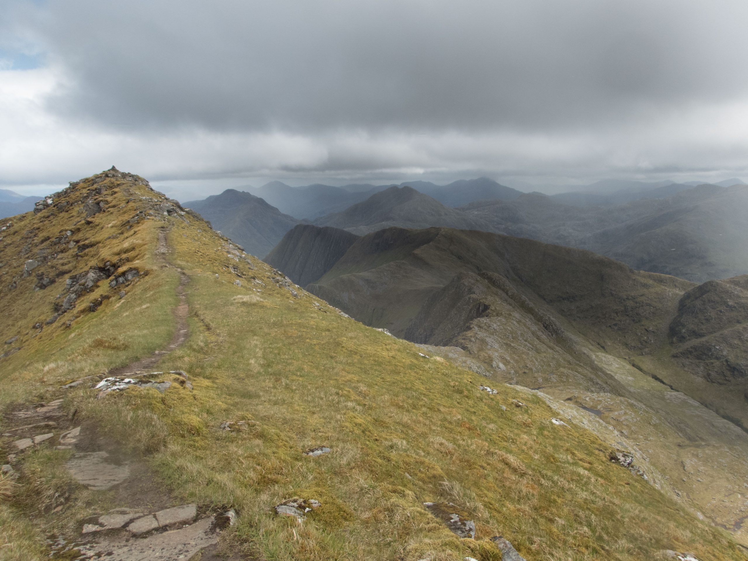
The map shows our route. We returned to the top of the pass that we came over the previous night. We then headed north west aiming for Stob a Chearcaill en route to our destination the local munro and high point Ladhar Bheinn. Although cloud filled much of the sky it stayed high and did not detract from a fabulous walk full of interest underfoot and fine views to the hill around and the sea and islands to the west.
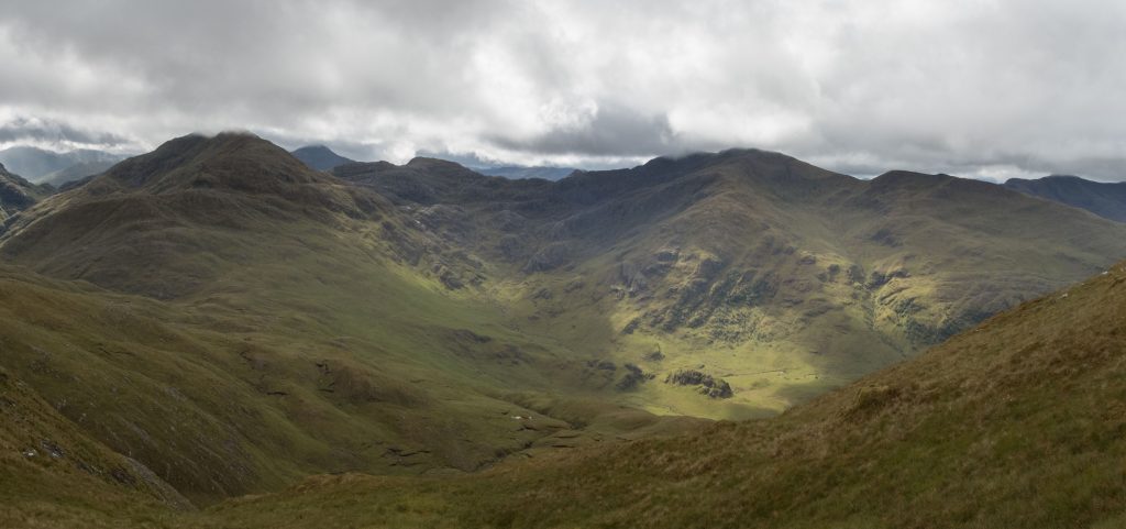
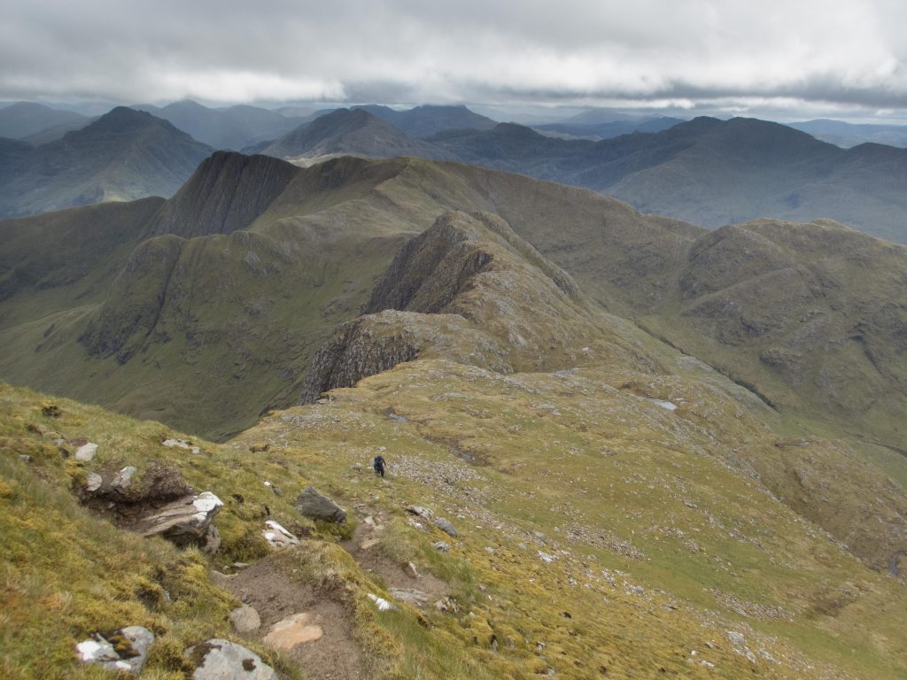
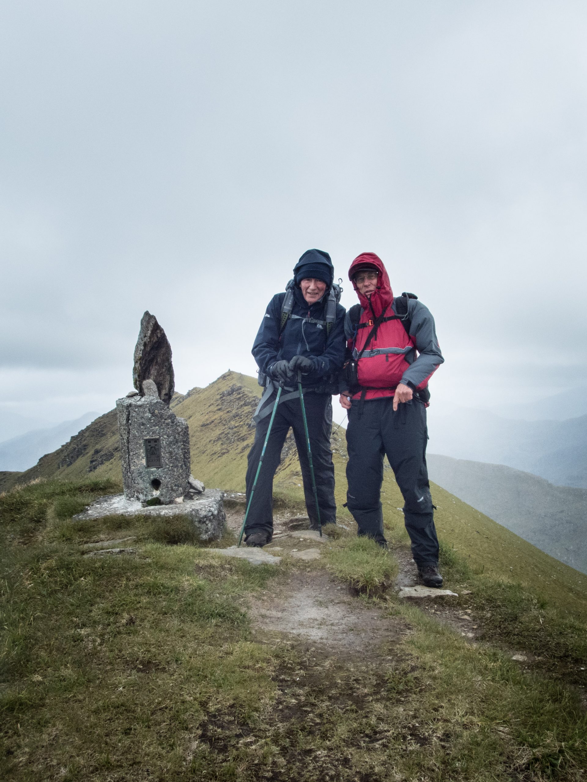
The summit is a narrow ridge a little over 500m long. We arrive at the eastern end with a view back along the route we ascended. To the north east is an adjoining ridge which we will follow down to Barisadale. The western end point across the Sound of Sleat to the Isle of Skye.
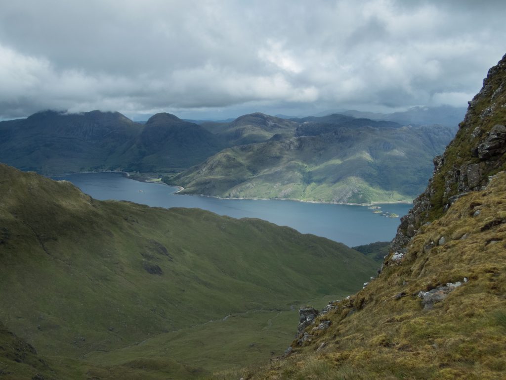
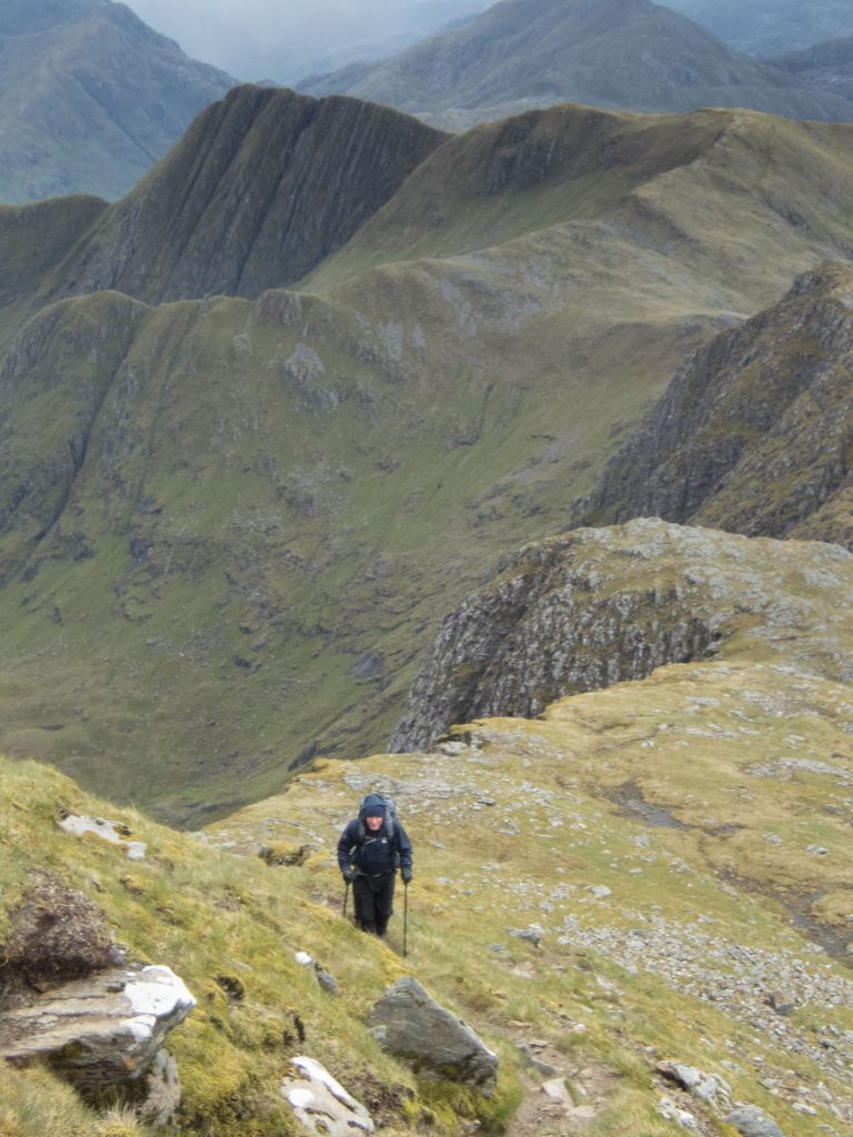
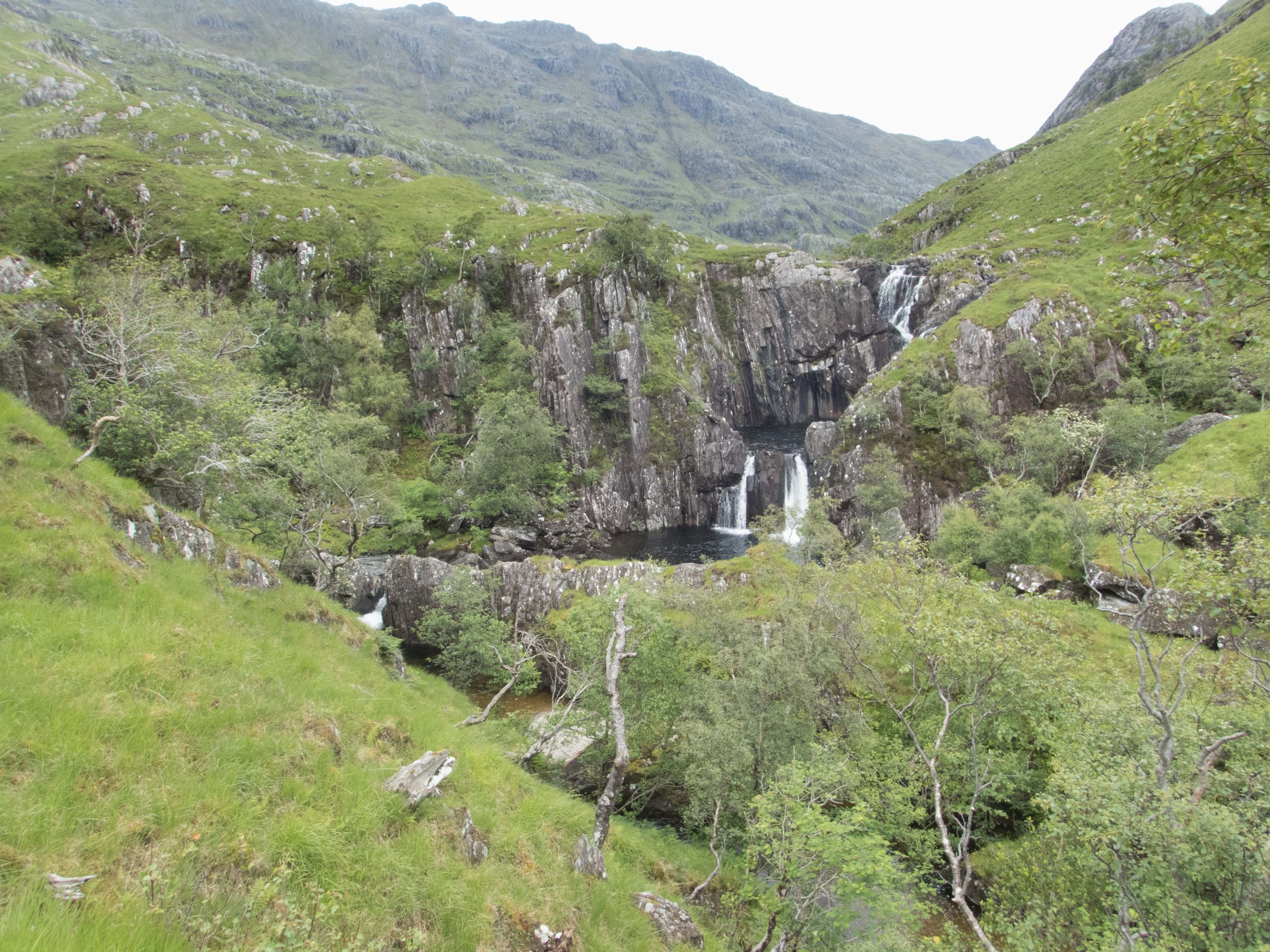
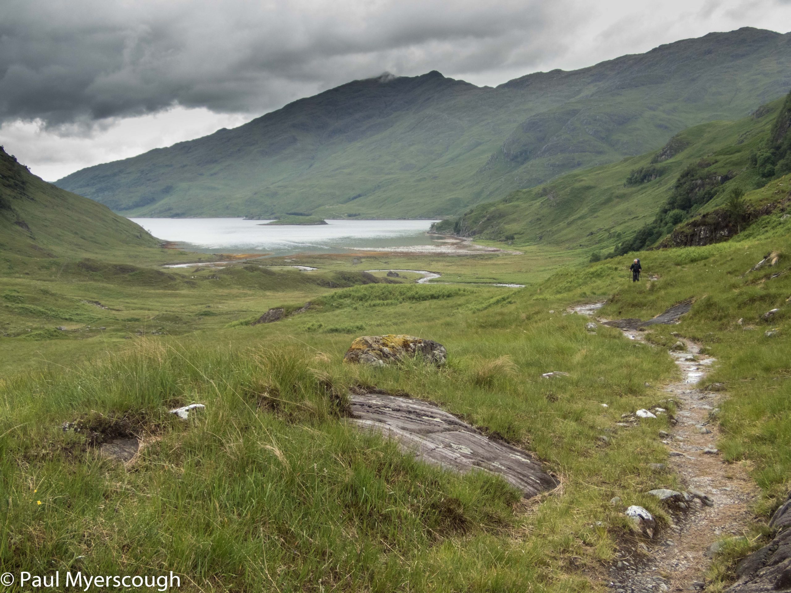
The route down follows the east ridge, then drops into the attractive hanging valley of Coire Dhorrcail. There are great views over Loch Hourn below.
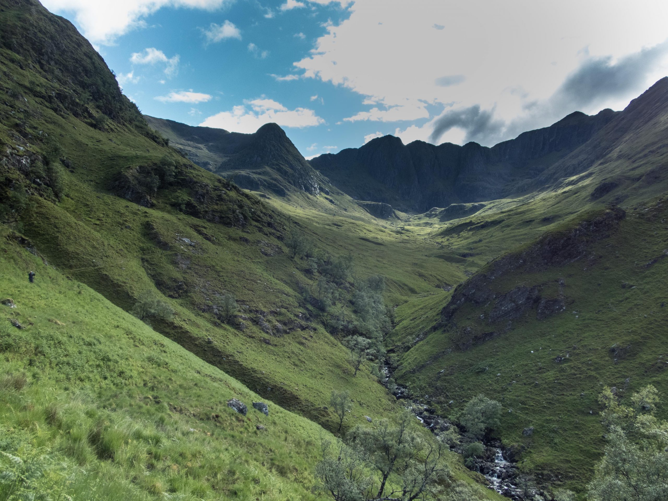
The walking is rough until a path is joined on the east side of the valley. From here a narrow route, probably more used by deer than humans, works its way down towards the loch, then heads east over the lower ridge of Creag Bheithe to reveal the flat valley bottom with Barisdale on the far side.
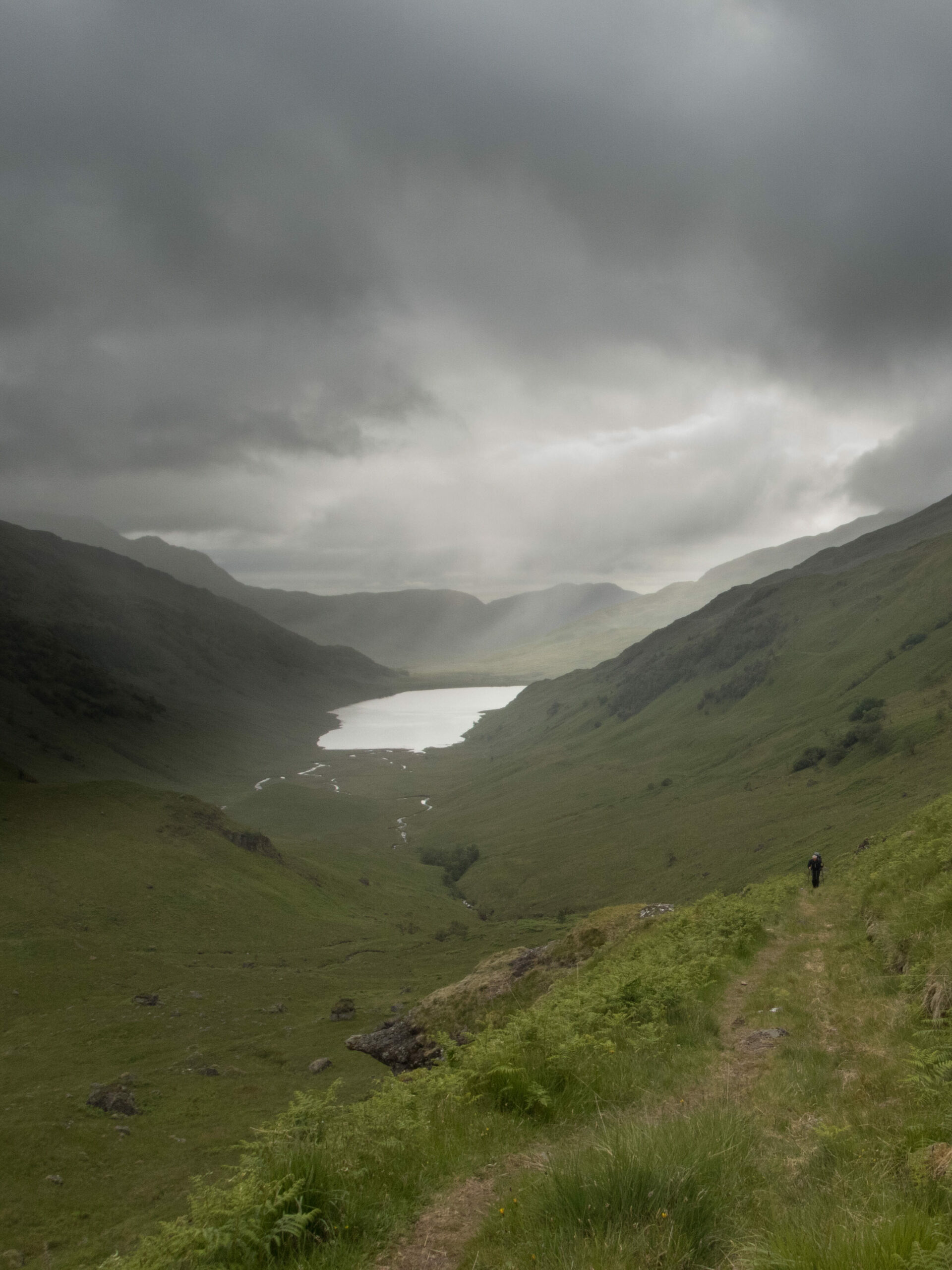
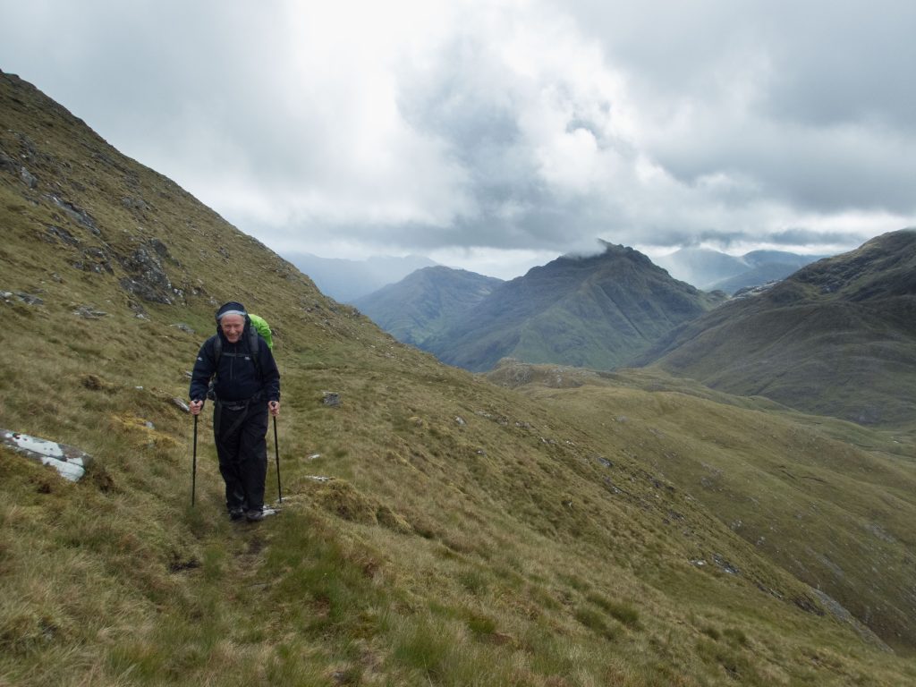
15km and 1300m of ascent was a good test to start us off. It was clear that my ambitions to stay high were unlikely to be realised on this trip. The circuit took more than 11 hours and my companion was in considerable pain. For day 3 the first main alternative routes were similar in length, the first involved a high camp, whereas the second brought us down to spend the night at Sourlies bothy.
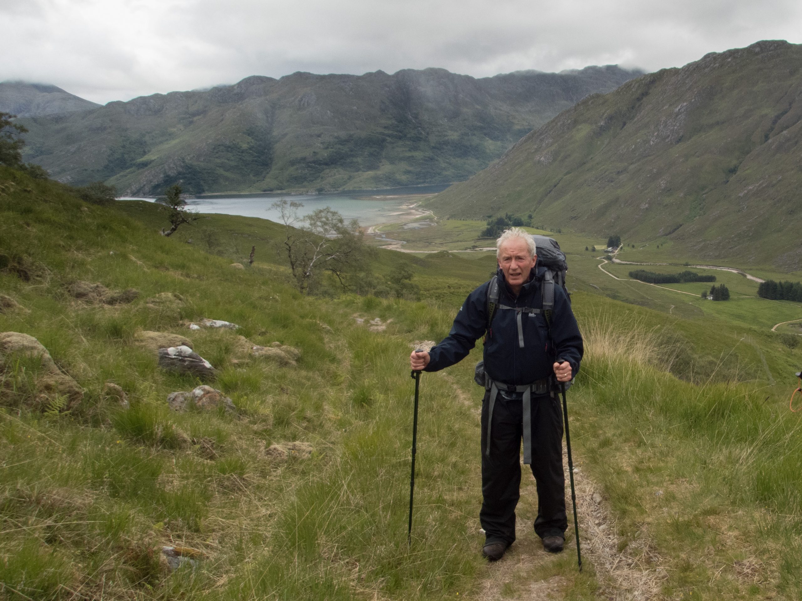
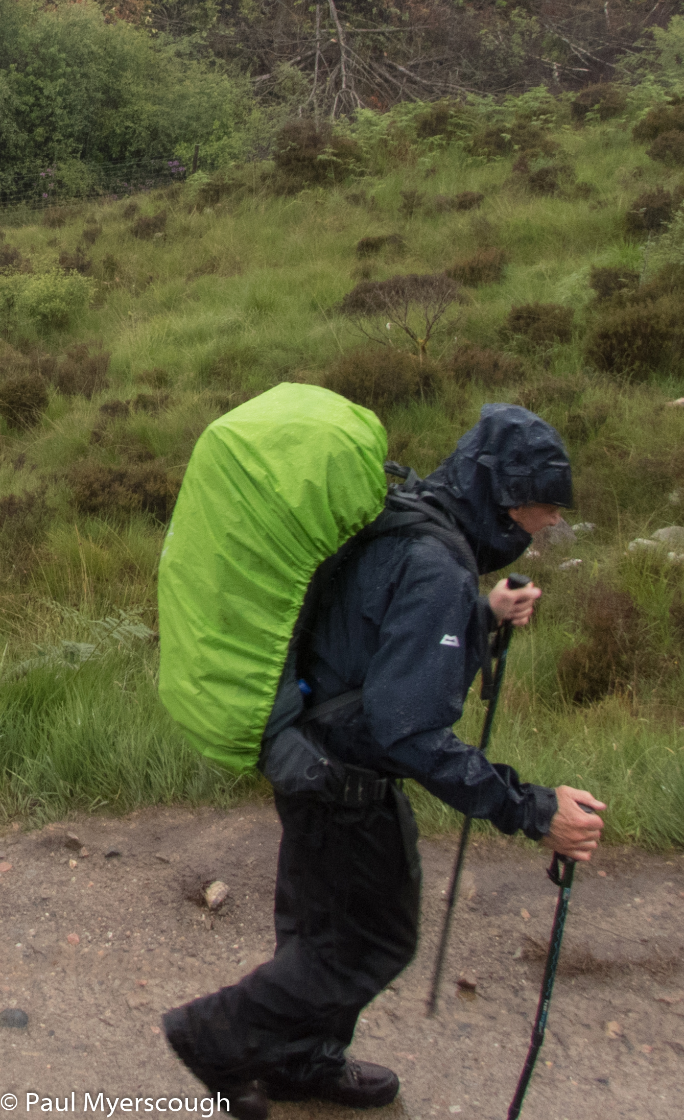
That left us with the FWA route – the foul weather alternative. This follows the valley bottom of Gleann Unndalain to around 550m then drops down to River Carnach which leads to the coast and Loch Nevis. This is actually a stunning walk which I have taken a couple of times before, but in the opposite direction.
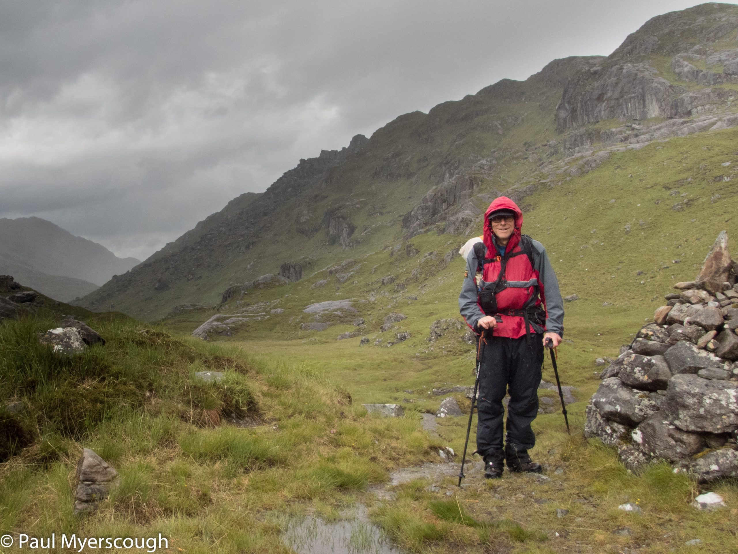
It was well after 8 o’clock when we struck camp and headed off into the drizzly morning. Four hours later we reached the half-way point at the Carnach river. T. was probably more ready for a day on the beach but he gritted his teeth and walked on through the pain in two dodgy knees.
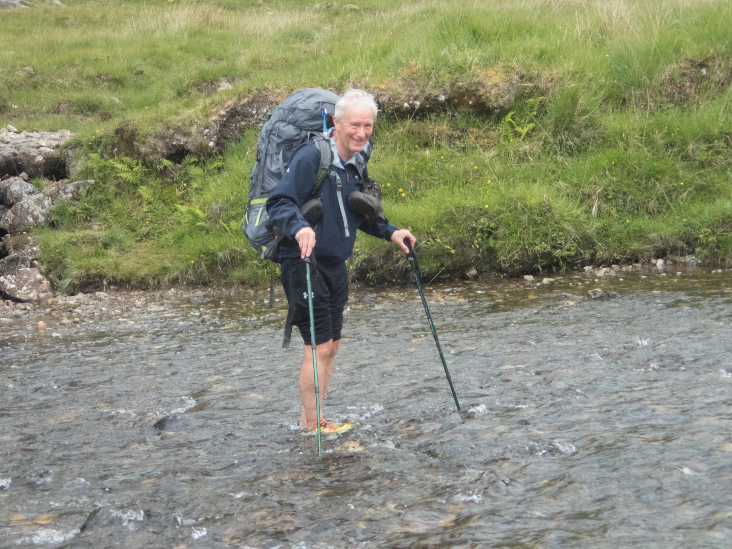
The river is attractive with inviting looking pools. After some hesitation we decided not to take a dip. The path is not well used but can still be extremely muddy and wet, but after a dry month we did not have any problems.
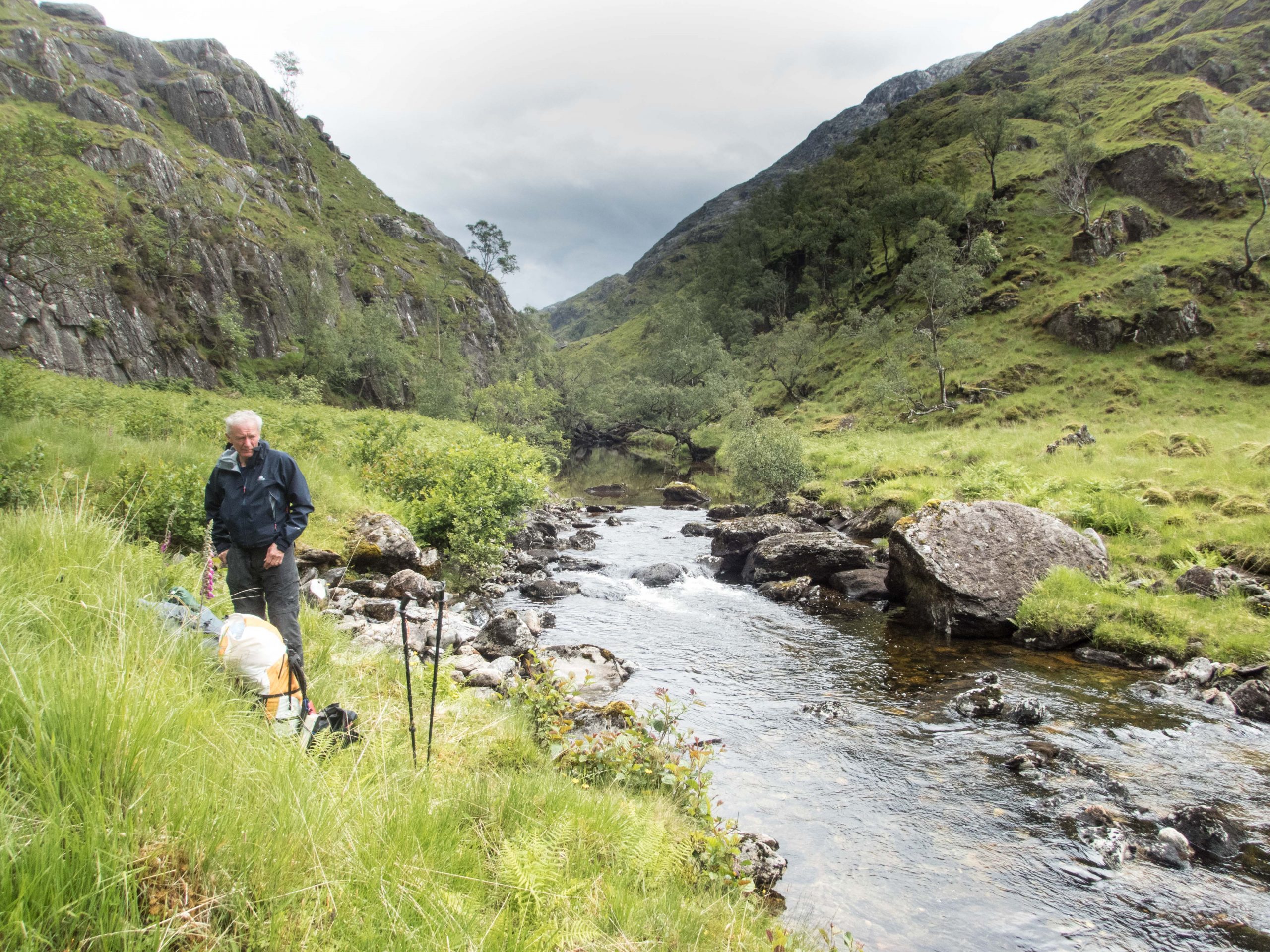
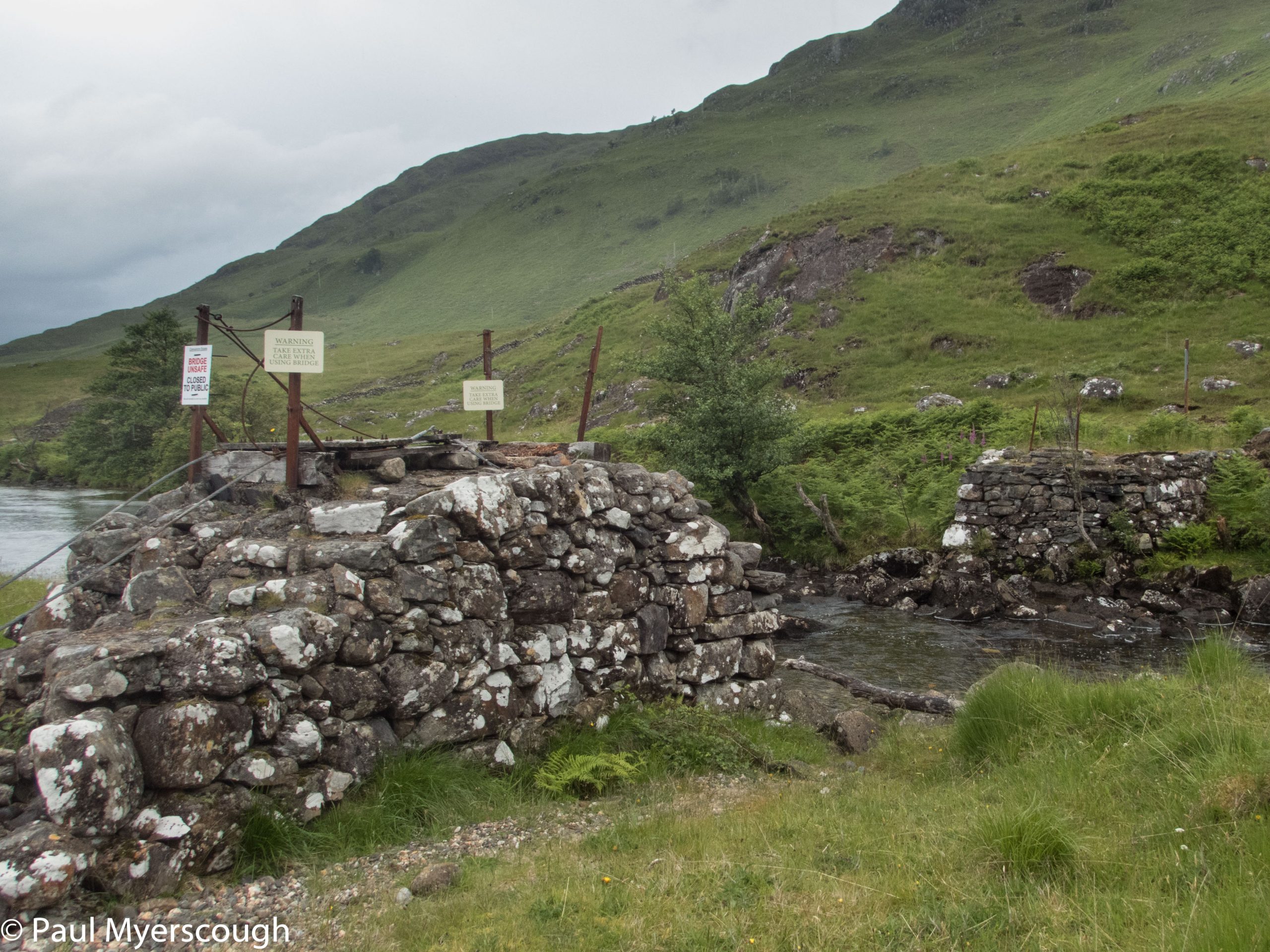
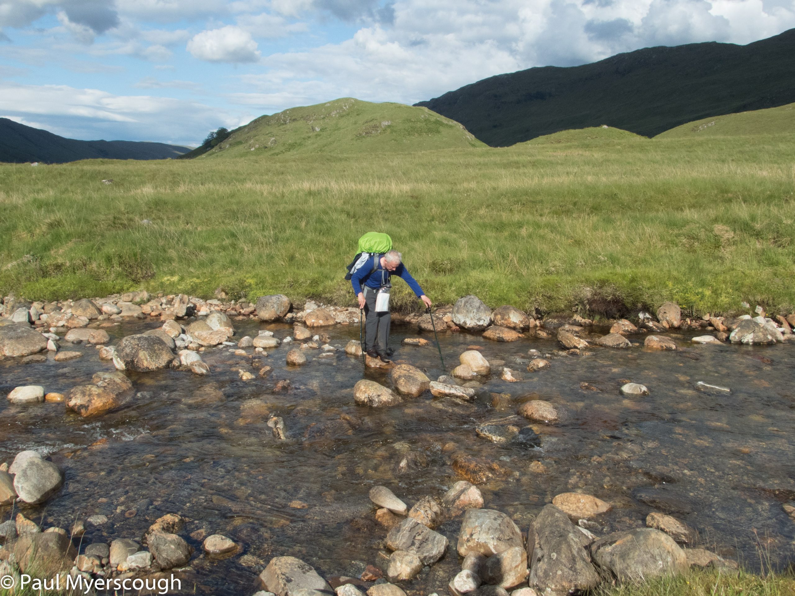
There has been an issue with the bridge across the river to Sourlies which has been damaged and unsafe to use for the last two years. We have prepared ourselves for a tricky walk through deep water but, fortunately, the river was quite shallow where we crossed just a short way upstream from the site of the old bridge.
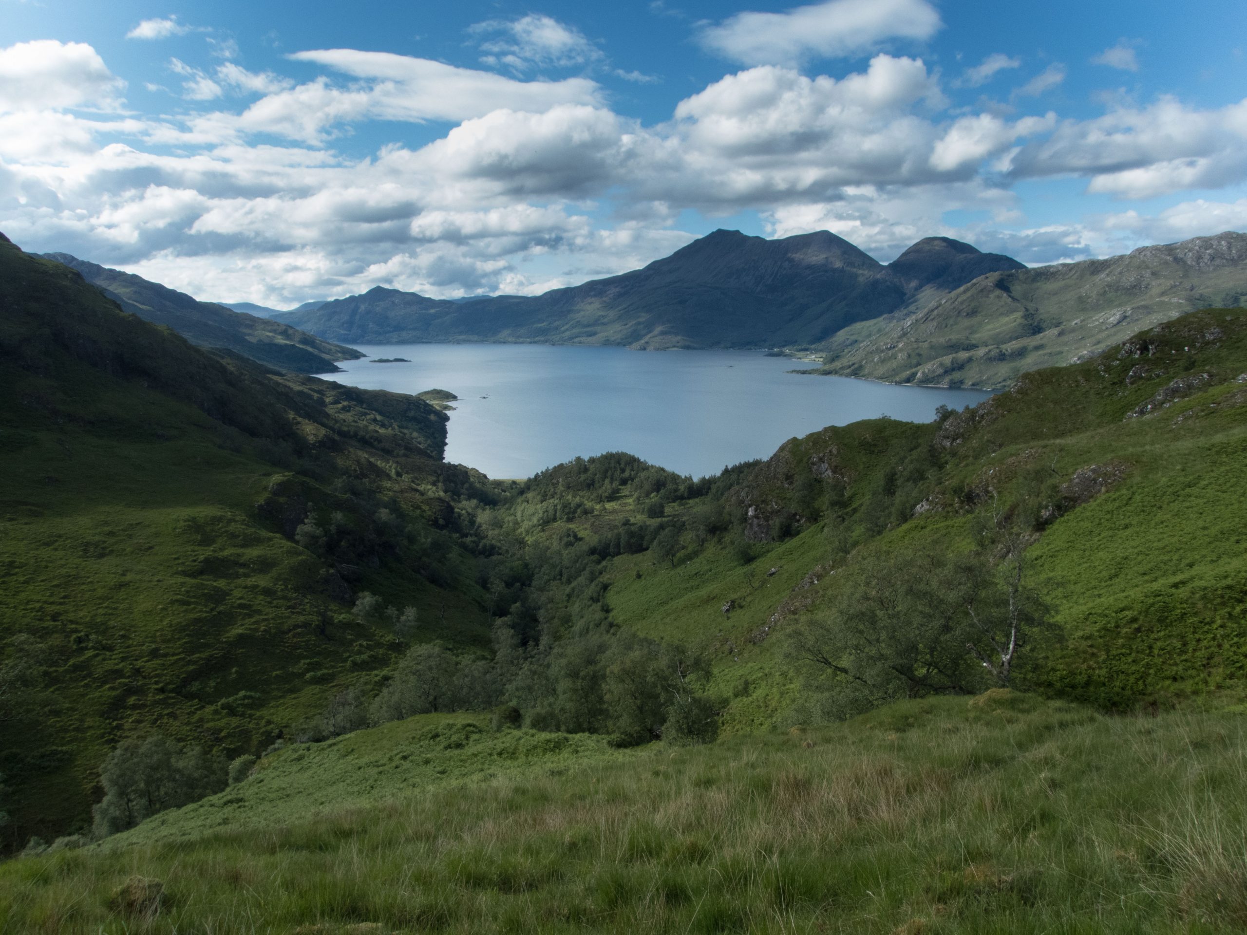
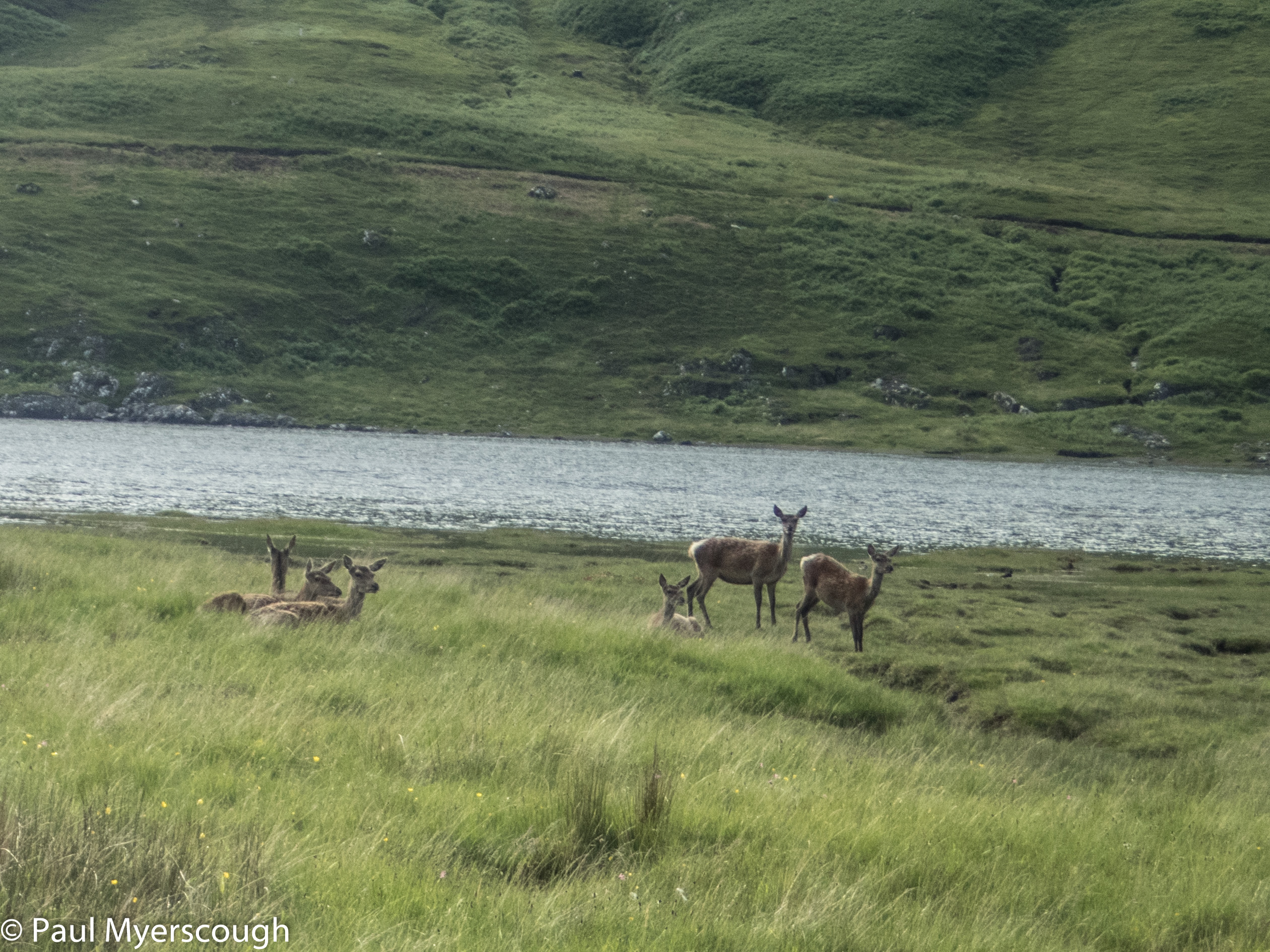
There is a wide plain at the mouth of the river which empties into a branch of Loch Nevis. In quiet times there are often deer hanging out here and so it was today. Sourlies bothy is around a corner to the left. It is easily accessible along the beach at low tide but today we had to navigate the side of the hill above water without finding any definitive path.
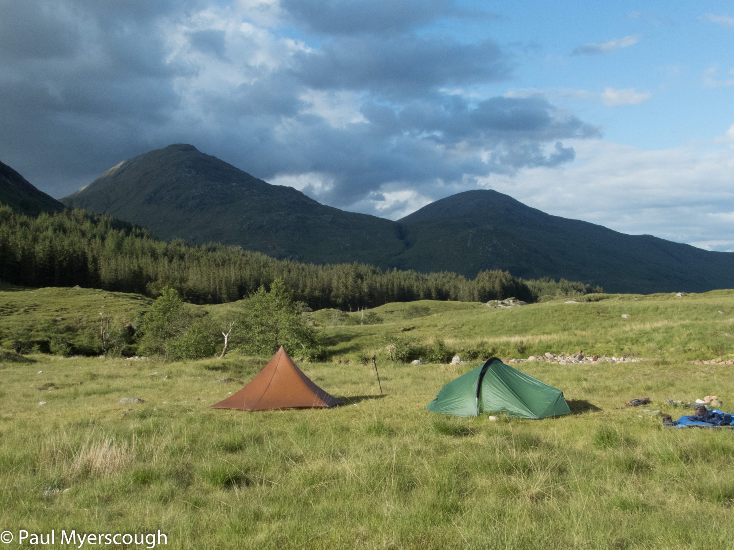
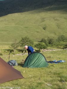
The bothy is well maintained and a favourite stopping off point for those passing through on the TGO Challenge. T. likes the idea of not pitching the tent for and decides to spend the night inside. In spite of the midges, I and the two Germans we meet pitch our tents overlooking the shore where we can watch the sunset.
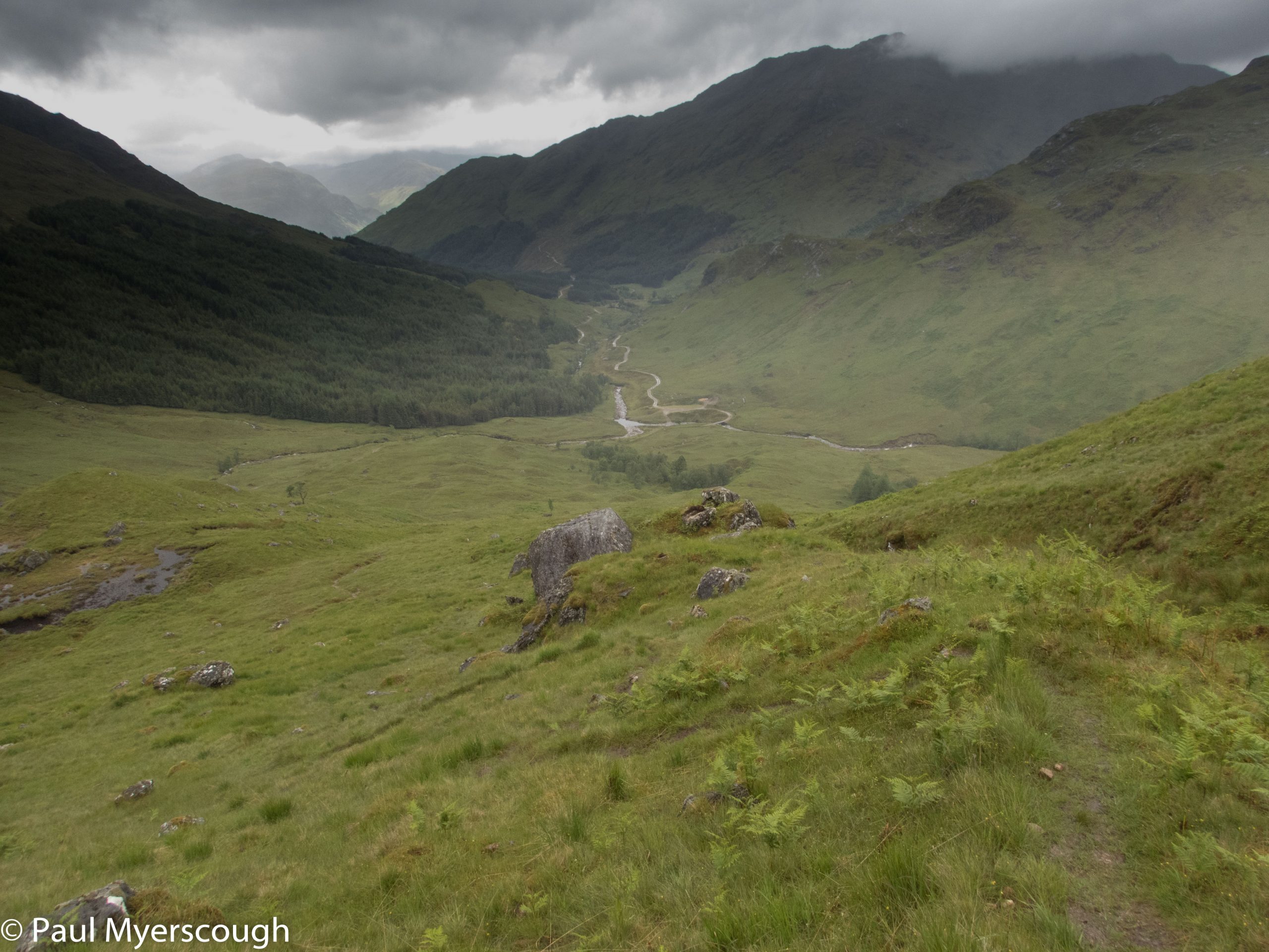
Reflecting on the day, there is no prospect of taking a high option in the morning. We will keep on the FWA route in the valley bottom to reach our final night’s camping spot in Glen Pean. With our detailed plan we can see this will involve a bit more distance but less elevation.
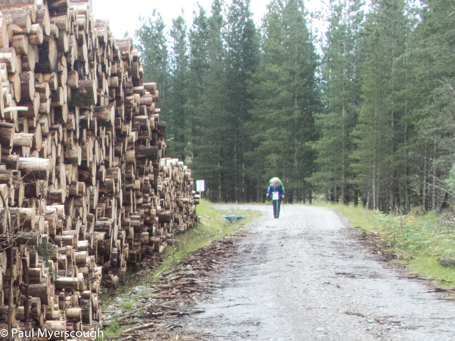
We meandered slowly upwards in the rain to reach the highest point after 3.5 hours. Now we could look forward to some downhill and then flat walking. The path however follows the fence at the edge of an enclosure for 2 or 3 km until the road is reached; this can be quite uncomfortable. Dessarry is not one of my favourite glens, despite some interesting and high hills on either side.
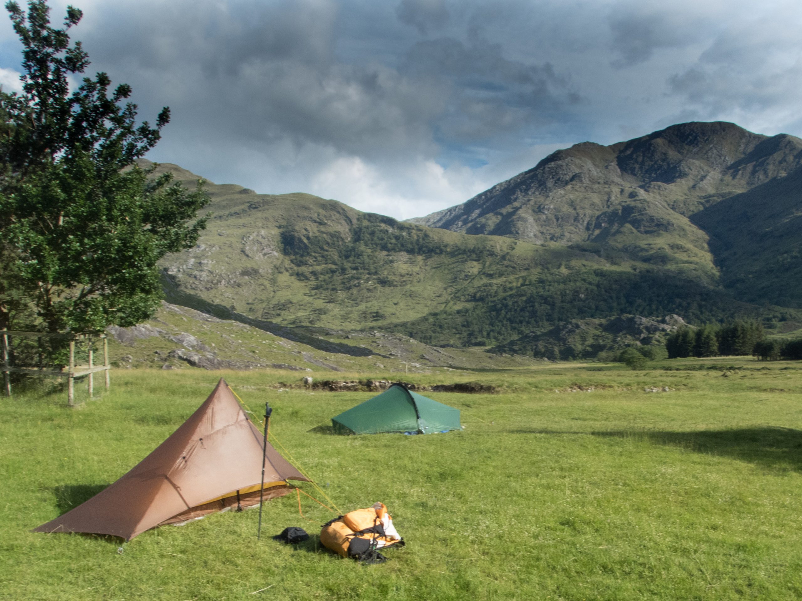
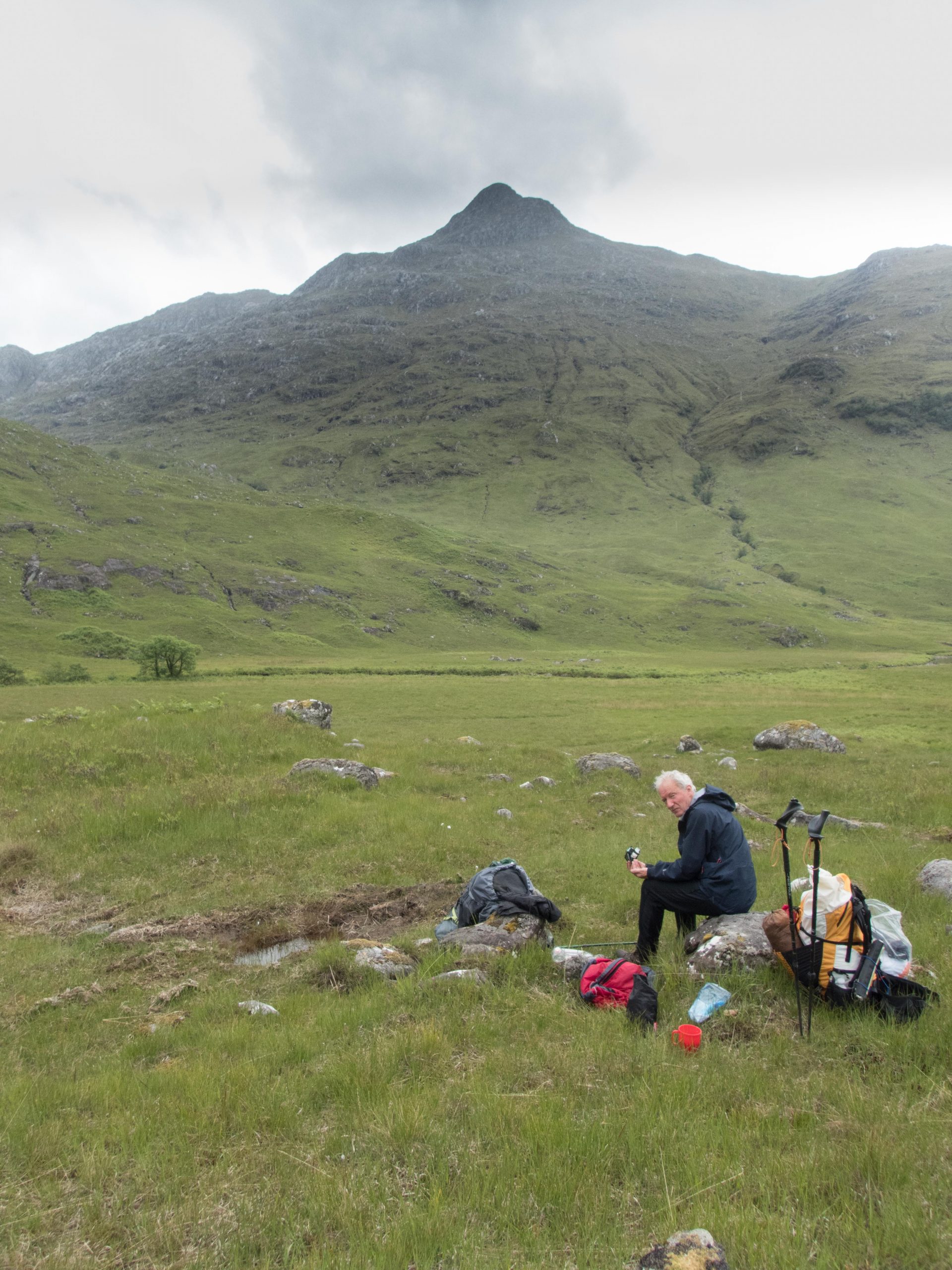
At 5 we reached a good spot to pitch our tents. The plan was to stay by the bothy but that was 4 or 5km further on the forest track, and this was a much better option for the next day. It is always good to have a few hours to relax in the sunshine before sleeping too! Our enjoyment of these idyllic surroundings however was marred by midges – to eat in comfort we had to shut them out the tent or constantly move around to avoid them settling on our faces. Thankfully we both had face nets.
T. had persuaded me that he could manage himself the next day if I wanted to go separately. The low level route to Glenfinnan was quite straight forward and it was hard to imagine anyone getting lost. I would follow the ridge above from where I could look down and check his progress.
This worked quite well, although waving to the small figure below got no response. The route up Sgurr Thuilm was pathless. Navigation in the cloud on the top required a compass and GPS helped me to descend rather than follow the ridge around to the west. Once out of the cloud, and on the the grassy slope of Druim Coire a Bheithe I could see a familiar figure again below.
Now on the road, he was moving faster, and I had to double my efforts – not ideal with a big pack. I managed to catch up a little after Glenfinnan Lodge and surprise him from behind. He hadn’t realised I had been tracking him from above!
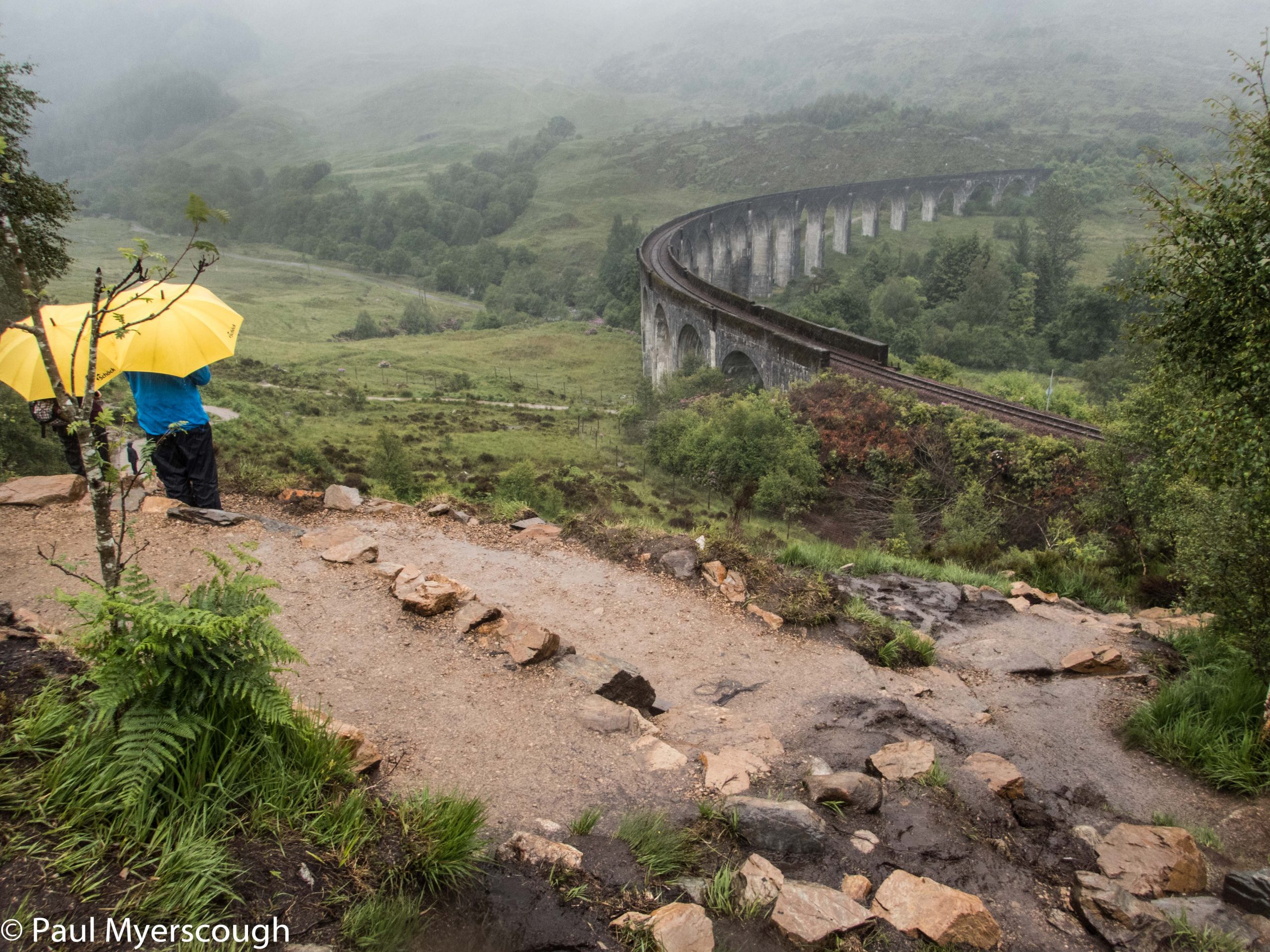
It is always a bit of a surprise returning to civilisation after being in the wild. And so it was at Glenfinnan. We expected a quiet station where we could pick up the train to Fort William. In fact there was a buzz about the place even in the pouring rain. Viewing terraces had been sculpted out of the hillside to enable tourists to look down on the railway viaduct. There were people wandering in all directions.
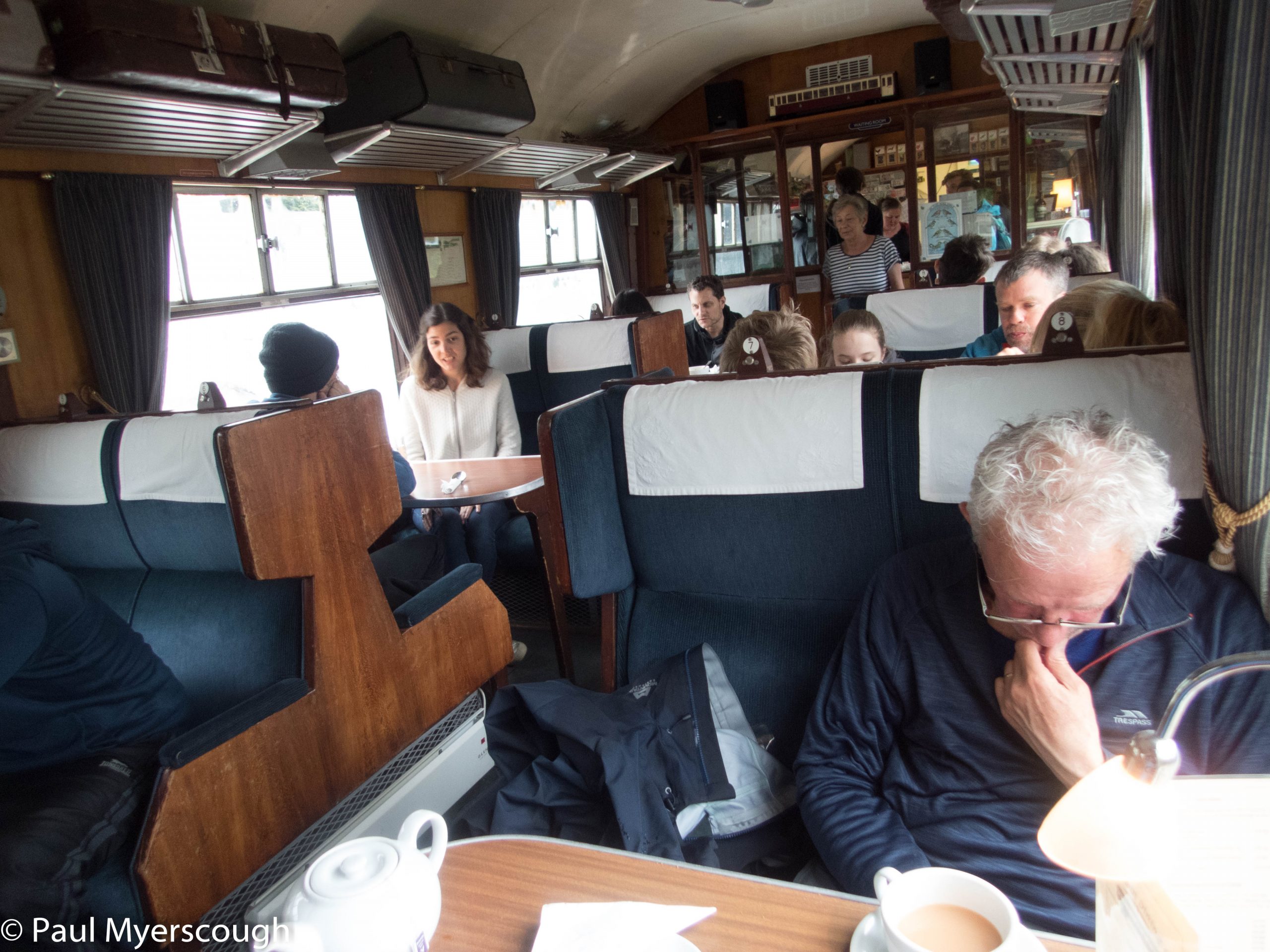
Close by the station we found the tea carriage. One table, two pots of tea, and plenty of of cake was all we needed.
The local train took us back to Fort William where we managed to arrange a shower in good time for the night train back to London. We were less surprised this time when there were no new carriages. Clean and calm we were happy to bag our cabins and then head for the dining car to order the best of what was on offer and reflect on our adventure.