Sunday 10th May South Shiel Ridge
(note1: click on a picture to enlarge it … Push and pull the map in the window below to see the route (days 1-4) in blue. The route walked was slightly different from the plan!)
See here for the fabulous start to this Challenge!
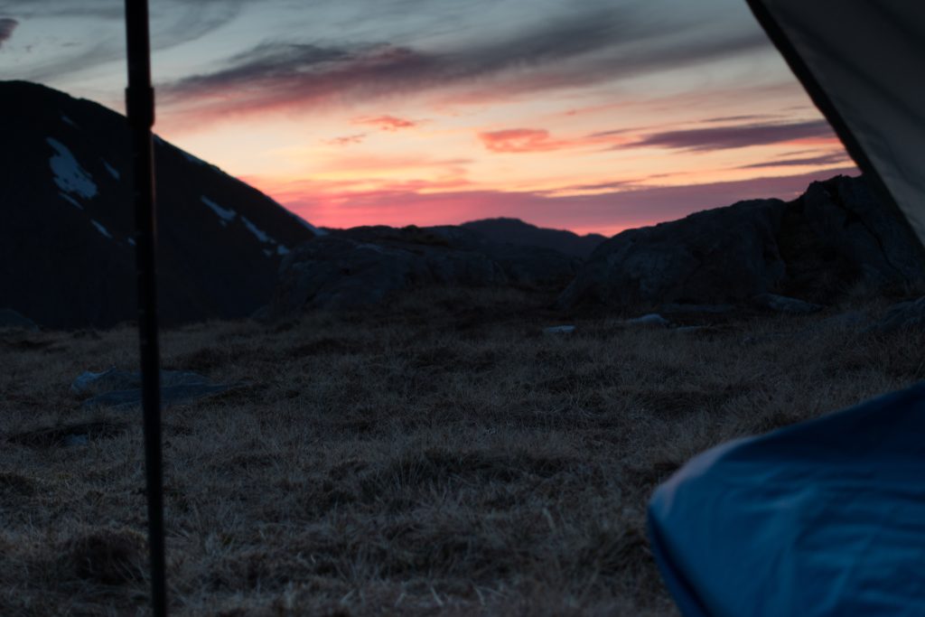
Download file for GPSThe first two days were so good, could I expect more of the same? We say “red sky at night shepherd’s delight” meaning good weather expected, but I woke with cloud swirling around the tent. The prospect was not good.
I set off with little visibility, but without wind or rain. As I dropped down to the first bealach – Fraoch Choke the clouds parted and I glimpsed the valley below and the path up ahead. A good omen – I decided to continue up high.
The tops on the South Shiel ridge include some munros: Creag nan Damh (918m), Sgurr an Lochain (1004m), Sgurr an Doire Leathain (1010m), Maol Chinn-dearg (981m), Aonach Air Chrith (1021m), Druim Shionnach (987m), Creag a’ Mhaim (947m).
After taking my first cloudy photographs it began to rain. I had a dry bag for my camera handy, but rather than use this straight away I put it in the pocket of my new PHD shell with its waterproof zip. A Sony RX100 mk3 recently bought specially for backpacking trips, this would never be used again. A few hours later I found the pocket was full of water, the camera soaked. Sony later indicated that it was ‘beyond economic repair’.
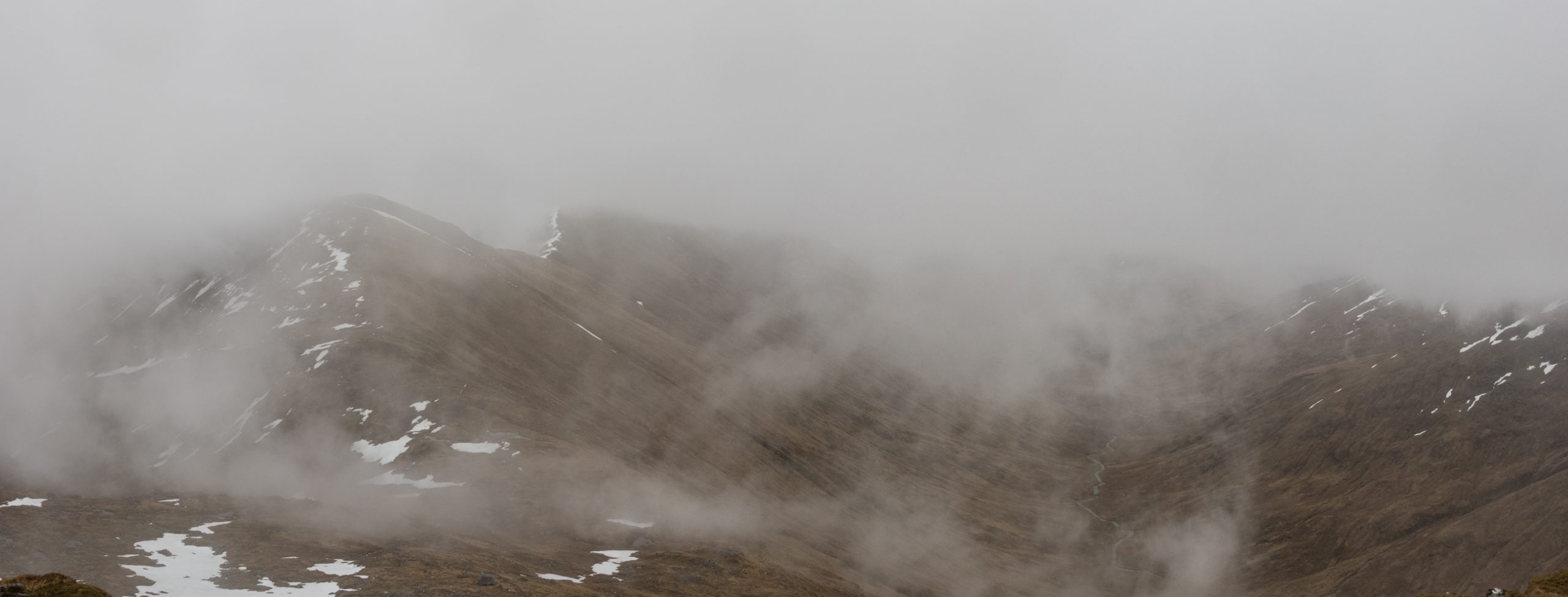
This was a tough walk. The rain continued all day, the wind was relentless, and cloud limited visibility to 10-20m.
A snow bridge lead across the bealach below Sgurr an Lochain. The narrow top was partly flatted by the boots of those who traversed it the day before. The extent of the drop on either side was hidden in the mist. Crossing this was an act of commitment.
The ridge had patches of snow which obscured the path. It was impossible to see far ahead so I often had to rely on footprints from the day before to show me the way. On the few wider areas these were far from distinct, and one time I needed my GPS and map to get back on track.
The biggest hazard was the wind. On the more narrow and exposed parts I was fearful that a gust could blown me over. The poor visibility made the going slow, requiring good and continuous concentration.
By 5 I had traversed all the munros without any views, and at last I was heading out of the cloud. The zig-zag path was a river racing down the end of Creag a’ Mhaim to Glen Loyne below.
A day of rain does not leave much behind on a narrow rock ridge, but down below the story is different. Wide areas of wet land and standing water were waiting for me. The rivers and streams had become swollen, noisy, fast flowing and challenging.
The ridge has been taking me east; as I arrive in the valley I need to head west a little to find the crossing point over the river Loyne. I have two streams to get over:- the first Altt Choire Odair takes 30 minutes to negotiate; the next one almost an hour, with a long climb up to find where I could cross it.
At the valley bottom I’m presented with two more difficult streams. One is between me and the ford over river Loyne shown on the map, the other bars the way upstream where I know the Loyne will eventually become smaller. It’s almost 7 pm, I haven’t seen a soul all day, and weary, I decide to call it a day and pitch camp.
Monday 11th May Glen Loyne, Tomdoun
My nightmare is that it rains through the night and all the crossings are even worse by morning.
I wake as it gets light at 4:30. It is still raining. I wait until after 7 to rise and at 9 I’m ready to walk off after a couple of hours without heavy rain. I decide to head upstream. Away from the fording point, but to where I know the river Loyne will be puny enough to cross even in spate.
Next to a ruin, shown on the map, the river is split around an island and I can easily wade across. The valley has many ancient trees, a few alive and standing but most are buried under the peat with the occasional wood showing red against the black earth. I have 3 or 4 km to get back on the path. By 11 I’ve regained the track over towards Glen Garry and coming tentatively towards me I find a couple of Germans worrying about the crossing point.
They are travelling the Cape Wrath trail. One of them shivers uncontrollably – he explains that he forgot his waterproof trousers. I learn later that they cross the river successfully without a diversion. [Another TGOer explains that it is impossible for the normal crossing point to be more than knee deep – next time I will find out for myself].
My vetter discourages me from going down to Loch Loyne and, following his advice, I headed directly to the road near Tomdoun passing the camping placed used on my first challenge in 2011.
In planning I wanted to avoid the road and go south of the river Garry, but I was behind schedule and I followed the advise to take the road along to the bridge at Torr na Carraid. Striding purposefully in the opposite direction was a solo walker who stopped to pass greetings. He was following the Scotland National trail, and seemed to know the TGOC well. It turned out this was Colin Ibbotson.
The weather was better now and I was looking forward to walking the ridge of Sron a Choire Gharbh, a hill on my original plan for 2011 and thwarted by sore feet. It was too challenging to complete this today, so I called the Great Glen hostel and arranged to arrive a day later, and started to look for camp spot.
I eventually ended on the hard but level track. The wind was rising considerable and I used a number of large stones to anchor the Trailstar to the ground.
Tuesday 12th May Glengarry Forest to Laggan Lock
High wind and intermittent rain had continued through the night. The rain stopped as I was ready to move off.
The track ends with a gate onto the open hillside. The path remains distinct for a short while with signs of motorcycle tyres. These soon disappear and in spite of a signpost pointing to Kilfinnan the route is unclear. In fact it keeps on the east side of the river and staying here leads to an easier descent on the other side.
My plan is to cross over and take the ridge up. When I reach around 700m the rain has started again and the wind is strong enough to make it difficult to stand, the frozen rain going directly into my face.
Thwarted for a second time, I head back down and cross over to the path which I follow until it disappears. Studying the map and the land in front of me I go back to the west side of the river and traverse the lower slopes of the ridge I hoped to be on top of.
This leads to some very steep slopes onto fenced farmland above the road. Although not difficult to negotiate by then it is possible to see the path again on the other side which would provide an easier route down.
A kilometre down the road Laggan Locks provides a stark contract with the wilderness just left. Tourists arrive here by car or boat, and wander around in the sunshine, and there’s a stream of walkers on the Great Glen Way which provides a level and civilised path between Fort William and Inverness.
I reached the Pub on the Barge, the Eagle at around 12:30. It was open even though this was Tuesday. So how could I not go in? I resisted the temptation of a fancy meal for dinner (these have to be ordered in advance), knowing I could rely on bar food favourites like Lasagne and chips if I find the energy later to return. Soup and bread made a welcome lunch.
The hostel is about 20 minutes walk away and arriving early in the afternoon provides a great opportunity to rearrange and check all the contents of my sack, arranging for wet things to dry in the drying room and the dirty stuff to be cleaned.
I managed to pick up a pre-ordered gas canister and some dried food. Although they do not cook meals there is a selection of frozen meals and groceries to support self-catering.
My tiny room had a computer terminal with a slow internet connection. I had been there but a short time when I had calls from home and from challenge control. My Spot tracker which became infamous last year by failing to work for a couple of days, had been misbehaving again. This time it worked fine for three days then started sending the wrong message. The concept is great as a tracker and safety device, and I don’t know of anyone else who has had a problem with it. So I resolved to buy the newer version as replacement.
It is easy to faff around with gear for hours given the opportunity – and this I did, eventually repacking for a smooth getaway in the morning.
Sorry to read about your camera, Paul.
So much for the "Waterproof" zips on the PHD Alpamayo.
Have you been in contact with PHD? They should compensate you for the camera.
I can't understand why they ditched the storm flap that was on the original Alpamayo. Even if the zip is slightly open water will get in.
Enjoying your TGOC diary and I'm looking forward to the next instalments.